#10, 1906-29: (Satellite) Served by the CB&Q.
#12, 1906-24: (Satellite) Served by the IC.
Both Class I (CN and BNSF) railroads still go through this town.
 |
| Larry Joe Jenkel posted Old Ben #10 Christopher, IL |
 |
| Andy Zukowski posted United Coal Mining Company in Christopher, Illinois. 1907 |
 |
| Andy Zukowski posted Ziegler District Colliery Mining Company operated a mine and tipple in Christopher, Illinois in 1907. Dennis DeBruler: There isn't a Zeigler in the Illinois directory of mines. But judging from another one of your posts, https://www.facebook.com/groups/1467664233256543/posts/6244321042257481/, this was the United Coal Mining Co. Matthew Wright: Dennis DeBruler Zeigler coal company was definitely hete. |
 |
| Dennis DeBruler commented on Andy's post https://wikiimage.isgs.illinois.edu/ilmines/webfiles/topo-mines/christopher.pdf |
 |
| LC-USF34- 026819-D [P&P] LOT 1100 Ziegler number one coal mine. Zeigler, Illinois |
 |
| 1936 Herrin Quad @ 62,500 |
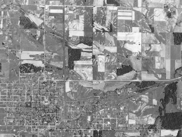
This photo caught both of the mines.
 |
| 1938 Aerial Photo from ILHAP |
Some trees still mark where the wye was that connected the mine's spur to the CB&Q mainline.
 |
| Satellite |
 |
| https://wikiimage.isgs.illinois.edu/ilmines/webfiles/topo-mines/christopher.pdf |
 |
| https://wikiimage.isgs.illinois.edu/ilmines/webfiles/topo-mines/christopher.pdf |
Update: Old Ben #11
.jpg) |
| Larry Joe Jenkel posted |
 |
| Directory |
Old Ben #11 is on the above ISGS topo map. I had to get another aerial photo to follow the CB&Q spur to the #11 mine. It is interesting that none of the USGS topo maps mark the extension to #11 even though the mine was active until 1953.
 |
| 1938 Aerial Photo from ILHAP |
Today's Indian Creek road was built on the spur's RoW. The tipple was built over the tracks and just east of the waste pond. Many of the trees mark where the railyard was.
 |
| Satellite |

No comments:
Post a Comment