Sunday, November 28, 2021

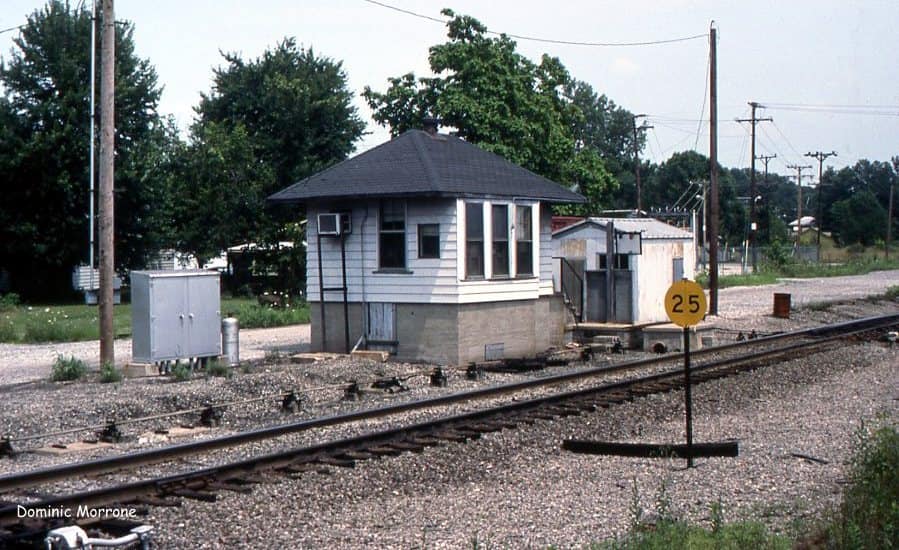
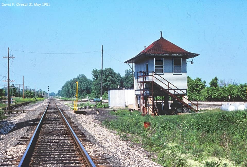
Milan, IN: B&O (MI) Tower

(Satellite)

I find it interesting that CSX quit using this B&O route in Ohio and Illinois but still uses it in Indiana.  

Bob Weston posted
Photo of closed "MI" tower on the B&O's St. Louis Division at Milan, Indiana. Photographer R J Weston Date 7 October 1994.

Dennis DeBruler commented on Bob's post
I like it when the street view driver is enough of a railfan to go down the side streets.
This was Depot Street. I wonder where the depot was.
39°07'27.1"N 85°08'05.0"W

Darren Reynolds posted three photos with the comment: "B&Os 'Milan' tower, Indiana."
Larry McLin: Double track from there, east. Champs 1954.
Chuck McAbee: B&O can be confounding - some of their Towers are visually 'cabins' and some of their Cabins are visually towers - HN Cabin case in point.
1

2

3

Jim Bainter commented on Darren's post
August 2008. The tower was still standing boarded up and painted white. My picture.

Tim Shanahan shared another post of the three photos by Darren Reynolds with the comment: "B&Os 'MI' tower...Milan, Indiana."
Mark Hinsdale: Home of the real life high school basketball team the movie "Hoosiers" was based upon.


Saturday, November 27, 2021

Ohio City, OH


Darren Reynolds posted five images with the comment: "EL Ohio City. "RE"    Ohio city,OH.    ( Date unknown)"
Joshua Frederick: Another place where sadly absolutely nothing remains.
1

2

3

4

5

George Pappas Sr. commented on Darren's post, cropped

Clarke McAllister posted  in Facebook
[Clarke's comment indicated that in 1987, Ohio City still had Erie Lackawanna, Cincinnati Northern (PC), and NKP Clover Leaf.]

West Lebanon, NH: B&M Westboro Yard: Roundhouse and Sandtower

(Satellite)

Phil Edson posted
The Westboro RR Yard showing the Roundhouse around 1915.
Rolando Maggi shared

Mimi Hains posted
Jim Kelling shared with the comment: "West Lebanon, NH (Boston & Maine facility, gone)."

Unlike in the Plains States, it is hard to get street views of buildings because of the trees. But sometimes a parking lot is your friend. Here we see part of the south end of the roundhouse.
Street View

And this view lets us see some of the north end and the smokestack.
Street View

safe_image for Westboro Rail Yard demolition hits tipping point in West Lebanon (paycount 2)

This view shows the land for the propane yard that the city will not be able to use for the new park.
Street View

The propane yard is new because the tanks have yet to be installed in this satellite image.
Satellite
Dennis DeBruler commented on the safe_image post
In addition to the sand tower, they are also tearing down a roundhouse and smokestack.
43°38'39.1"N 72°18'40.8"W


Friday, November 26, 2021

Springfield, OH: Cold Springs (CS) Tower: Big Four vs. P&E vs. Erie

(Satellite)

Rick Giles posted six photos with the comment: "Larry Stone: Like Cory said, LS&MS, not Big Four. Big Four had a branch to Sandusky (long abandoned) from the southwest but the bridge wasn’t part of it. Cold Springs was a significant location on the old Big Four Cincinnati Division. It was the tower that controlled the junction with the Erie's Dayton branch from Marion, Ohio which the Big Four would use to avoid the bottleneck through downtown Springfield. The Dayton branch would join with the Big Four's Cincinnati Division main line to Cincinnati to form a paired right of way with the Erie being the westbound main and the Big Four being the eastbound. The plant also included a turnout west of the tower that sent trains onto the Springfield branch that was the back way into Indianapolis.  The first photo is the view looking geographically and timetable west down the Big Four main. It shows the crossover all eastbound trains would use to get on the Erie to Glen Echo where Big Four trains would rejoin home rails. In the second photo the DT&I's eastbound DC-8 is using this crossover to run up the Erie to Maitland where it will use the connecting track there to get onto DT&I rails. The third photo shows a PC manifest from downtown Springfield coming off the Big Four main onto the crossover over to the Erie and is just about to foul the eastbound crossover from the Big Four main. In photo number four, the Conrail train is swinging around the curve on the connector to the westbound Erie main. Cold Springs was originally just an armstrong interlocking plant and photo five shows some of the levers and the trackage layout on the model board. In later days on the New York Central, Cold Springs was used as a control station for the Control Points in downtown Springfield. The last photo shows the control panel and trackage layout in downtown Springfield in the early PC days. In Big Four days there was a significant amount of export coal that was interchanged from the L&N at Cincinnati that went to Sandusky, Ohio on Lake Erie that went up the Erie. All trains not having work to do in downtown Springfield used the Erie as well including all the Cleveland and Toledo hotshot manifests. After the CSX and Family Lines merger, and the opening of Big Four yard in Indianapolis, less traffic came through Cold Springs. That being said it was still a significant enough facility to remain open well into Conrail days finally closing sometime in 1986 I believe.DB is still active under NS ownership and sees Amtrak’s Lake Shore and Capitol Limiteds."
Cory Behrendt: Cold Springs lasted until '91 I believe. Cool photos!
1

2

3

4

5

6

Jon timothy Wilkins commented on a post
I have a dispatching simulation that has a Cold Springs-Springfield track simulation that you might find interesting.....it is a long jpeg so you might want to download it to view it more closely.

Darren Reynolds posted five photos with the comment: "Cold Spring tower. (CS)    Springfield,OH.     1987-88    Photos by Rich Ballash    Don't know RR??"
Christopher Allen Howe: The original railroads at Cold Springs were the NYC Big Four, the Erie, and the P&E line to Indianapolis(also an NYC owned RR). It also controlled where the PRR connected to the NYC at Springfield from its Branch out of Xenia.
1

2

3

4

5

Because the P&E became part of the Big Four and because the Big Four became part of the NYC, I had to go back to a really old topo map to find a distinction between the P&E and the Big Four. Note that the P&E joined the Big Four mainline in the upper-right corner of this excerpt.
1906 Springfield Quadrangle @ 1:62,500

By 1955, NYC built a bridge across the Mad River and curved down to join the Big Four mainline west of Cold Springs. Part of the original P&E route was abandoned and the old route out of Springfield evidently became an industrial spur.
1955 Donnelsville and Springfield Quadrangles @ 1:24,000

In fact, the new bridge still exists even though the P&E route is now abandoned.
Satellite

As recently as 1962, the larger scale maps showed the old P&E route. It could not find where P&E, Big Four and Erie crossed each other until I found the above 1955 map. I was using the larger scale maps to include where the Erie met the DT&I and Big Four on the north side of town.
1962 Columbus Quadrangle @ 1:250,000

The 1967 map does reflect the new route for the P&E. Today, the Indiana & Ohio Railway (IORY) shares the NS/Big Four route southwest of Cold Springs. And the Erie remnant on the west side of town is still used by the IORY to access its DT&I route. And that remnant continues to connect with the Big Four route north of town, which is now owned by the Indiana & Ohio Central Railroad (IOCR). The circuitous Big Four route through town is now the Simon Kenton Trail.
1962 Columbus Quadrangle @ 1:250,000


Hancock, WV: B&O Hancock (HO) Tower

Tower: (Satellite, I think that was the foundation for the tower.)
Depot: (Satellite)
Railyard: (Satellite)
 

This tower controlled access to the branch to Berkeley Springs. It was between the crossover and the turnout to the branch. The branch followed the Warm Spring Run, and it still exists to the U.S. Silica Co. plant.

Mark Hinsdale posted
Way Back Wednesday
"Color Coordinated"
A westbound CSX merchandise train with a couple "Stealth" liveried units in charge, passes the recently spiffed up "HO" Tower in Hancock WV, directly across the Potomac River from the "real" town of Hancock MD, in June, 1994.  "HO" controlled the junction of the branch to Berkeley Springs with the former Baltimore & Ohio (B&O) Cumberland Subdivision main line, along with eastward and westward sidings extending from here toward the west.  At one time, this was four track territory for B&O.  June, 1994 photo by Mark Hinsdale
Mark Hinsdale shared
Mark Hinsdale shared
Anthony Bonelli: Slug set.
 
Randy Voith posted
August 8, 1985, the B&O (Chessie) mainline from Brunswick, Md. to Cumberland, Md., looking east at Hancock, WV.  Photo taken from a signal bridge.
A dead storage line is on the far left.  The tower operator can be seen in the window of HO Tower.  And the Berkley Springs branch goes off to the right just past the last crossover.
Tim Shanahan shared
Jim Kelling shared
B&O “HO” tower (gone) in Hancock, West Virginia

Marty Bernard posted
B&O GP40 3703 westbound freight at Hancock, WV in early 1976. Bill Howes photo
Marty Bernard shared

Gordon Smith posted two photos with the comment: "CSX Train Q416 led by AC60-CW 685-HLCX C46-7EM 594-CSX C40-8W 7654-GP40-2 6118 is passing HO Tower, Hancock, WV on October 9, 2002.  Right on its tail came Amtrak 29 "The Capitol Limited" with P42DC 165-166 and 14 cars on its way to Chicago." 
1
[Note the signalling pipelines in the foreground.]

2

Darren Reynolds posted three photos with the comment: "B&O 'HO tower'  Hancock 
Hancock,WV.  (MD)."
Dennis DeBruler
It evidently controlled the crossover and turnout for the Berkeley Springs branch. That branch still exists to the U.S. Silica Co. plant.
1
[Note the signaling pipelines going to the crossover.]

2

3

Marty Bernard posted
7. B&O GP40 3711 built Feb. 1969 and became SP 7110 then UP 5380 then UP 1480, seen May 1975 at at Hancock WV. Bill Howes photo

Darren Reynolds posted seven photos with the comment: "B&O  HO tower  Hancock, WV."
Randall Hampton shared
1

2

3

4

5

6
I always like seeing a photo that includes signaling pipelines.
[The new Facebook allows you to write a comment, but when you hit enter you get a popup about joining the group.]

7

Darren Reynolds posted eight photos. I don't have time to figure out which one was new.
Steve Davison commented on the Aug 28, 2023, post and on a Mar 19, 2024 share
My dad, Chester Davison, in this same tower. Probably in the late '50s. About 5 miles from my home. Precious memories going to work with him on midnight shift.


Bob Weston posted
B&O's HO Tower located in Hancock, WVa. ca. 1990. R J Weston photo, R J Weston collection.
Jim Kelling: Tower was removed about 2010 or so.

Stanley Short posted
Baltimore & Ohio's HO tower at Hancock, WV on May 19, 1974.
Randall Hampton shared
Another tower with interesting letters.  If you model HO scale, then every tower on your layout is an HO tower.  😉
Eric Tomlin: That photo actually looks like a model to me. The structure is so typically found on model railroad layouts that I suspect it was a very common style found in that part of the country.
Randall Hampton: B&O standardized a lot.

Steve Davison commented on Stanley's post
Torn down years ago. My dad (in picture) was telegraph operator here for many years and took me to work with him occasionally. He had 40 years with the B&O/Chessie System. Precious memories.

Curtis Tat posted four photos with the comment: "HO Tower, Hancock West Virginia, April 2005."
Curtis Tate shared
1

2

3

4

Sheldon Nicholas Photography posted
The old station building at the CSX Hancock yard in West Virginia.
Kevin William Jones: They are restoring the station only, not the tracks

Street View, Sep 2023