You can gain access to the trail from Bluff Road, which can be accessed from Lemont Road.
 |
| Google Map |


On the left is the view from where the trail crosses Bluff Road. And on the right is the view you see when you go around the above corner.


Following the trail to the bridge, it becomes obvious that the economic purpose for the trail is as a maintenance road for the bridge. The following views are North where it launches from the valley's bluff and South across prairie and wetlands.


On the left of the above right-hand picture you see the tip of a mound. The trail curves to the right and goes under the bridge to get around that mound.


It then crosses quite a bit of wetlands until we get to the trail bridge that is over the Des Plaines River. This was built to provide access for construction, but it is now used for maintenance access to the trail and bridge. (I was impressed by the number of trash cans I saw along the trail.) The wetlands picture on the right was taken looking back after I had crossed the trail bridge.It is a small fraction of the total wetlands. The above link has links to more pictures.


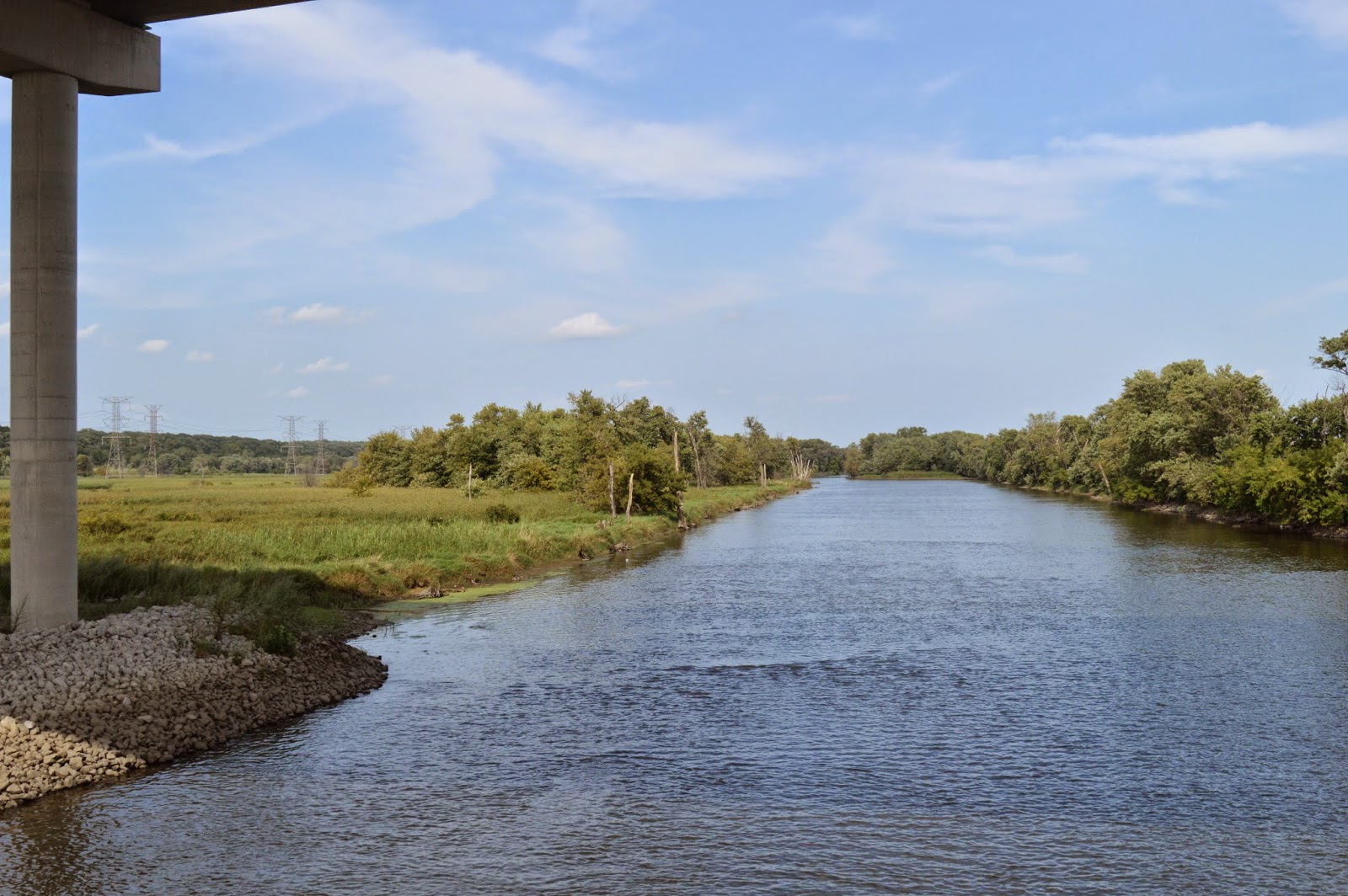
Crossing the trail bridge, we see the Des Plaines River to the Southwest and to the Northeast.

The trail tees at a trail that follows the Sanitary and Ship Canal. And we see the breech in the Asian Carp Barrier. Unfortunately, they do not provide trail head parking at this south end of the trail even though there is plenty of room. If there was trail head parking here, the Des Plaines River Drive would no longer be private, and I could use it. Trail head parking is at the east end of the Canal Bank Road so the public can still use that road.


But the canal trail parallels the Des Plaines River Drive so learning how to bike again so that I can do that trail, and others, is on my todo list.


At the end of the trail bridge, I took this picture to illustrate a couple of items.
 The box with the antennae on top had the signs to the right. (My picture was straight. The signs were crooked on the box.) The other item to notice above is the curve in the Asian Carp barrier fence. It goes around a fancy semi-circular paving. It is obviously an observation point. Unfortunately, after spending all of that money to make the observation point, they didn't spend any money on a sign explaining what you are supposed to be looking at. Furthermore, below is the best view I could find from that observation point. I assume the ragweed did not exist when they built it. And perhaps the foreground trees were much smaller. Is the point that the area has a swamp ecosystem as well as wetlands? I plan to revisit this view after the ragweed has died and the leaves are off of the trees.

 I took this view when I came back because I noticed the structure on the left of the bigger picture, which the left picture zooms in on.
When leaving, as I crossed back under the bridge, I took this view not to better understand the bridge but because of the strong geometry and because of the interaction between a man-made structure and nature.

No comments:
Post a Comment