Tuesday, December 31, 2019

Wauponsee, IL: K&S Depot and Grain Elevator

(Satellite, the town has disappeared)

K&S = Kankakee & Seneca Railroad

Kankakee and Seneca Railroad Company posted
Here we have a rare photo of the now long gone town of Wauponsee, west of Mazon. In the photo we can see the grain elevator as well as the rarely photographed Wauponsee depot. Also note the boxcar spotted at the elevator for loading.
Special thank you to the Grundy County Historical Society for the photo.
-Josh

Dennis DeBruler shared
Soon after the railroad builds a depot and water tower, someone builds a grain elevator.
Bob Summers Perhaps the elevator was the first one built if the area was already in crop production?
Bob Summers Dennis DeBruler ok, but in southwestern Kansas many farmers came west via the AT&SF mainline west from Hutchinson thru Dodge City and Garden City into Colorado, then homesteaded south and north before the railroads built their branch lines primarily to haul the grain and livestock produced to markets mainly in the east.
Bob Summers Most of those branch lines have been abandoned by the railroads since the late 1960's!
Dennis DeBruler I didn't realize that homesteading was done so far away from the initial railroads in the West. So elevators were built to motivate a branch line to be built.
Bob Summers Probably not before, but the railroads built sidings and leased land for elevators to be built, about every 10 miles in good cropland areas (because in horse drawn wagon days that was about as far as farmers could effficiently haul grain from the farm to an elevator) in order to generate enough business to justify the branchlines. Probably did put in watertowers where water was available, but depots were not the first priority. Actually my great grandfather brought his family from southeastern Iowa to Cimarron in southwestern Kansas in the 1880's to homestead over 20 miles south of Cimarron and set up a general mercantile business in a townsite in the central part of what would become Seward County because the Rock Island RR had surveyed a right of way thru there. Within a couple of years the Rock Island resurveyed and built their line to the Kansas State / Oklahoma Territory line and founded the town of Liberal Kansas. The several merchants that had set up shop relocated and were in Liberal day one.
.
The oldest topo map I can find was 1958, and the K&S was long gone by then. But the town was still on the map
1958 Aurora Quadrangle @ 1:250,000

Dennis DeBruler commented on the Kankakee and Seneca Railroad Company post
In a 1940 aerial, it appears the town was already disappearing. Does the red rectangle mark where the depot was?


Monday, December 30, 2019

Disco, IL: Old Grain Elevator

(Satellite)

KJRY/TP&W

One of 44 farm scenes posted by Sam Carlson. November 13, 1983.
Jeremy J Schrader Fantastic! Just lots of storage cars parked here now.

Dennis DeBruler commented on Sam's photo
The old grain elevator is still standing. The mainline has mainly tank cars. But the elevator's siding has three flatcars with interesting racks. (Thank goodness for shadows.) At first, I thought they were centerbeam cars. But when I looked closer, I noticed that the top of the racks are not connected. I wonder what these cars are designed to carry.


Sunday, December 29, 2019

Castleton, IL: Wood Grain Elevator with Bolted Steel Bins

(Satellite)

Jerry Krug posted two photos with the comment: "Two photos of the elevator at Castleton, IL taken August 4, 2018."
1

2

Wesley Peters posted two photos with the comment:
Castleton, Stark County, IL
J. A. Klock Elevator. Built before 1903 (exact year unknown).
Photographed on 10/27/2024.
Photos courtesy of Wesley Peters.
1

2


Saturday, December 28, 2019

Putman, IL: Grain Elevator with a "truss" or "super-flow" across a railroad

(Satellite)

This is one of those rural towns that has almost as many grain silos and bins as houses. Andy Miller posted the following photo on a post concerning grain facilities near Onida, SD.
Andy Miller commented on a post, cropped

Andy Miller commented on a post
This is Rumbold & Kuhn’s Putnam facility. The “truss” or “super-flow” is what we call the conveyor on the catwalk you guys are referring to. It’s a belt conveyor if you were wondering, has been “Grandfathered in” since years ago when the facility loaded out by rail. We haven’t loaded rail in many, many years from here but I think that’s why even when we had to take it down to put support towers underneath a few years ago, we were allowed to put it back up. But it was a major hassle and a lot of money and paperwork involved to let that happen. It was actually pushing the concrete silos that it was anchored to away from each other, so it had to be done.

6 large bins have been added to the south since this picture. Along with a dryer upgrade on the highway side, the scale was moved, and the concrete dual overheads and pit near the highway were knocked down as well.

Also, the 3 small bins near the highway near the shed to the south have been removed, and a pit added near the pad. Which has been eliminated as well, thank god.
The railroad was the Rock Island. It is now operated by Iowa Interstate (IAIS).

They went with bolted-steel silos rather than slip-form. It is interesting that they added a big jump-form silo across the tracks before adding another small jump-form silo on the highway side.


One of 44 farm scenes posted by Sam Carlson. On July 10, 1996, four pieces of EMD power lead a southward Iowa Interstate train through Putnam, IL.
Mike Tisdale Interesting arrangement of the silos on either side of the track. Gives the trains a frame. So, this is the Rock Island Peoria line, eh?
Dennis DeBruler A conveyor across a railroad's mainline is rather rare. I understand a lot of paperwork has to be filled out to do this.
Sam Carlson I wonder if the conveyor went in when the line was abandoned after the Rock quit in March, 1980. Then the line ran in fits and starts for awhile until ownership was settled. EJ&E tried running it for a month or two; then some outfit came along with 5 yeller U30Bs and that didn't work out either. CSX got in on it, too.
Dennis DeBruler 1980 would be consistent with bolted steel and jump form silos on the west side and then a larger jump form silo and bins in the east side expansion. I had checked a 1939 aerial to determine that this elevator expanded from the west side.

Street View
A 1939 aerial photo supports the theory that the elevator started on the west side and then grew on the east side rather than merging two elevators into one.
1939 Aerial Photo


Friday, December 27, 2019

Franklin C: Royalton, IL: Oct 27, 1914, Gas Explosion

(Satellite)

Roger Kujawa posted two images with the comment: "Royalton, ILLINOIS - North Coal Mine Day of Explosion - Oct. 27, 1914 post card. That’s all the info I have."
1

2

This is the first time I have tried working back from a location to a coal mine name. Given that the postcard referred to it as "North Mine," I'm assuming it was the mine with the index of 57. (I wonder where the boundary was between mine 57 and mine 145.)
Map

Directory
GenealogyTrails
Indeed, it was the Franklin Coal and Coke CO., Mine #1. 52 men died because of a gas explosion. The explosion occured soon after the men started their shift at 7:00am. [GenealogyTrails] "Up to 11 o'clock rescue parties were unable to penetrate more than 1,500 feet in the workings, but at that hour the rescue car came from Benton, Ill., with four hours supply of oxygen. This made possible a further penetration of the mine by the rescue parties. General Superintendent MITCHELL said he could not account for the explosion as the mine had been in continuous operation and no gases had been detected. Lines of hose were carried down two shafts and attempt was made to direct streams of water thru cross shafts to the burning level. The bases made it dangerous for the fire fighters to approach close enough to do effective work. Experts said the fire could be controlled only by sealing both entrance shafts and pumping water into the mine until all the chambers were flooded. This, however, will not be done until all hope of rescuing the imprisoned miners is abandoned."[GenDisasters]

392 men were at work when the explosion happened. 13 of them were members of the newly formed Protection of the Holy Virgin Mary Church. It is a Russian Orthadox church and services were held in Slavinian until around 1971. [TheSouthern-2015]

Wayne Hinton has an in-depth explanation of the rescue work and some photos. And this is one of several gas explosions that Wayne Hinton describes.

According to my 2005 SPV Railroad Atlas, Mine #7 was a little south of Mine #1.
PhotoGrammar

RoyaltonIllinois
[Just when I thought I understood the mines, I come across a source that indicates the 1914 explosion was in Mine #7 instead of Mine #1. And there was another explosion on Sept 28, 2018, that killed 21 miners. Judging from the number of smokestacks in tipple photos, my current theory is that Mine #7 was the rebuilding of the tipple of Mine #1 in 1923.]

Satellite
As I was looking for evidence of abandoned railroads, I noticed a couple of large cemeteries. The coal mine donated land after the 1914 explosion. Not only do miners have to contend with the risk of explosions, they also died because of occupational hazards such as black lung disease and being crushed by machinery and roof collapses. I wonder if any other town in Illinois has a higher ratio of cemetery plots to houses as does Royalton.

I first noticed all of the cemeteries near the town when I determined the topo map was less accurate than the Abandoned Railroads Map further below.
1968 Christopher Quadrangles @ 1:24,000

Abandoned RRs
The green line at the top of this map is an abandoned Illinois Central branch. The mine was served by the St. Louis, Iron Mountain & Southern Railway. [GenDisasters] My 2005 SPV Railroad Atlas indicates that the SIMS had a branch coming north from the route below Royalton that is now operated by the Union Pacific. That atlas indicates the SIMS was acquired by the Missouri Pacific and that the MoPac abandoned it. My 1928 RR Atlas has that line, but there was no room for them to label it. In fact, there are so many railroads in the area because of coal mines that the map doesn't have room to label the route that still exists. But other routes in the area are labelled MoPac, so I assume that would be the 1928 name of  this branch as well.

I could not figure out how the MoPac branch ran north through Royalton until I looked at a 1938 aerial photo.
1938 Aerial Photo
Abandoned RRs plus Paint
I added red lines where I think the MoPac/SIMS branch was and where the IC curved around to join it. Below, I zoom into the tipple area.

1938 Aerial Photo
at photo resolution
Update:
Scotts Oddyseey Holy Cow... look at that Right Angle turn. I have a video coming up about one of those that totally decimated a Circus Train.

In response to this comment, I posted the above 1938 aerial with the comment: "Here is a 1938 aerial from my notes on the coal mine to show the curve was smoother than my drawing. They had a small yard north of the connection.
https://towns-and-nature.blogspot.com/.../franklin-c..."

Scotts Oddyseey 1938... so there were still limits on cars and car length (30' cars, not more than 17 cars). I guess if this location is flat, then it is a nice gentle curve. I keep forgetting I am in PA, so the idea of a turn like that is just crazy (because where I am there is nothing without a >1% grade).

Thursday, December 26, 2019

Fulton C: Astoria, IL: Amax Sun Spot Mine and Lost/CB&Q Depot

Coal Mine: (see below for satellite)
Depot: (Satellite)

Justin Curless posted
Sunspot Amax Coal Mine Company Marion 8750 Dragline Astoria/Vermont illinois photo Complments of (Pek Boyett)
You can tell that this was a more recent strip mining operation because the swaths of been leveled. But I can't tell if they restored the top soil.
Satellite

Dennis DeBruler commented on Justin's post

Dennis DeBruler commented on Justin's post

Justin Curless posted seven images with the comment: "This is the only photos I have of the tipple Yard does anyone else have any more input or photos they wanna add to it or post?"

1

2

3

4

5

6

7

AbanMap

Justin Curless posted the comment: "If Anyone in this Group would have any photos of some sort of the tipple yard and or Exactly where the tipple sat of What used Sunspot Amax Coal Mine or photos in general of the Coal Mine."

Dennis DeBruler commented on Justin's post
 I presume the L shaped building on this 1979 Vermont Quadrangle @ 1:24,000 was the tipple facility.

Andy Zukowski posted
The Chicago, Burlington & Quincy Depot at Astoria, Illinois. Circa 1910

1944 Beardstown Quad @ 62,500

1938 Aerial Photo from ILHAP

Judging by the bridge in the photo, the new depot was built down by the "mainline."
Digitally Zoomed

Tuesday, December 24, 2019

Springfield, MO: Full Gasometer and Underground Storage Caves


Richard Crabtree -> BNSF Springfield Division
Richard's comment:
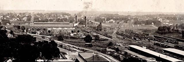
This is why I love researching history. I have never seen this before it was really like stepping back in time. It is 1911 and The Woodruff Building on St Louis Street in Springfield Mo just opened. This is the view west from the building. I would click on options and download to see it better.
On the Right just pass the Cook with Gas tank is the Frisco Station (gone) - to the left of that we see Frisco Frieght Depot (gone) - and then to the left again the Missouri Pacific Station (still there) - Behind all of that we see the South Yards and Shops - I have only seen postcards of these buildings, so I was quite happy to find this. I will try to chop up the picture and post a few of the sections in the comments
Photo - private collection
Photo - private collection — at Frisco Depot.
Richard considers the constant pressure tank to be just a landmark. But I consider it significant because it is the first time I remember seeing one full. So I'm saving this for when I get around to writing an article on coal/manufactured gas. He included three higher-resolution pictures as comments to the above posting.
"Frisco Station - before the 1920's remodel - now gone"
Frisco Freight Depot (gone) & MoPac Station (still there)
Note the wooden coaling tower in the middle of the picture.
Frisco South Shop and Yards - Yard remains buildings gone
Facebook Resolution
.

Underground Storage


Frank Keller Photography posted
An interesting BNSF operation at Springfield, MO where they switch various cold storage cars in these Limestone caves. 9.01.21
Roger Bartelt: There are huge fans that continues change the air from atop. I wondered that the first time I was in it. So I asked. Cause while you are checking in at the many different warehouses underground you have to turn your truck off. Once you get a dock door u unhook your trailer. then you go back out to the staging area n wait till you get called for your empty trailer.
Joe Kcjones: Picked up loads at several locations. Americold in KC, Kansas was my favorite. Crazy thing was that they were still blasting deep in the mine. You’re sitting in your truck and the ground would shake. Too bad they’re closed now.

Roger Bartelt commented on the above post
Oh the loads of cheese I hauled in there for kraft twice a week from Wausau Wis for two years. Then came back out n loaded pepsi loads headed back to wisc n northern Illinois. Enjoyed going in the caves in Springfield n north of Joplin Mo n a few others near Kansas City.
[I noticed Kraft Foods Distribution Center on the satellite map.]

Jonah Hemingway posted
BN Whiteface 1915 takes the North Yard Job out of the Caves at the Springfield Underground earlier today [Aug 12, 2024]. This units been seeing a little more service after returning from Phoenix with a freshly paint matched A/C Box. 8/12/24.
[And behind the BN livery is an H1 BNSF livery.]


Street View, May 2019

Leonard Fraijo, Dec 2021, cropped

Photo, Nov 2010

Photo, Nov 2010

Dave Blaze Rail Photography posted
Springfield Underground
This shot is on my calendar for August and is an absolute favorite and figured some of my newer followers might never have seen it. This is what I wrote when originally posted: 
Whenever I take these crazy annual trips I usually have about three goals of 'must have' shots.  Last year's trip focused on street running, and this year I had three rather obscure and diverse operations on my list.  I am pretty happy to have been completely successful with two of them and the third is no longer possible do to a schedule change. 
Anyway here is a different take on 'Trains Where Trains Shouldn't Be' this time in caves instead of on streets!  Ever since learning of this local I just knew I had to see it.  In Springfield, Missouri in the heart of Frisco country a few miles east of town, BNSF drops below the surface of the earth in this most unusual operation.  
In a former limestone mine the caverns have been transformed into 3.2 million square feet of leasable warehouse space with a constant ambient temperature of 62 degrees 100 ft below the surface. Amazingly these caves contain three miles of roads and three miles of rail sidings. BNSF local Y-SPM220 comes out 5 days a week and after switching the above ground yard curls down the steep loop past the runaway track and into the caves.  
Here is one favorite as BNSF 3181 (rebuilt EMD GP50 blt. Mar. 1981 as ATSF 3828) and 2797 (rebuilt EMD GP39-2 blt. Mar. 1975 as ATSF 3643) shove a dozen cars, a mix of hoppers and reefers, into the cavern.  This fascinating place began operation in 1960 when the first underground warehouse opened served by the Frisco and has vastly expanded since then.
Of all the images this may be my favorite as an employee in a helmet seemingly matching the units pops a wheelie on his bike heading down the road beside the train. 
Springfield, Missouri 
Dave Blaze Rail Photography shared