I have separate notes concerning the junction tower.
 |
| Roger Kujawa posted Mt. Vernon Illinois IL ~ Mount Vernon Coal Mine 1913. It looks like a railroad interlocking tower behind the coal mine seen through the legs. Roger Kujawa shared Dennis DeBruler I believe that tower was along the C&EI between Southern and L&N. What was the name of that tower? Since the tower in the photo is on a slight angle, I think we are looking eastish with Southern on the left and L&N on the right. |
 |
| Dennis DeBruiler commented on Roger's post It is easy to determine that the index of the mine is 752. Normally these maps have multiple numbers in a coal region. The grey number indicates the polygon and the bold number indicates the location of the tipple. This mine would explain why three railroads built so close to that spot. |
 |
| Dennis DeBruiler commented on Roger's post |
 |
| Dennis DeBruiler commented on Roger's post The problem with a mine that closed in WWI is that it is hard to find more info on it. The oldest topo map I could find doesn't show it. 1933 Mount Vernon Quadrangle @ 1:62,500 |
 |
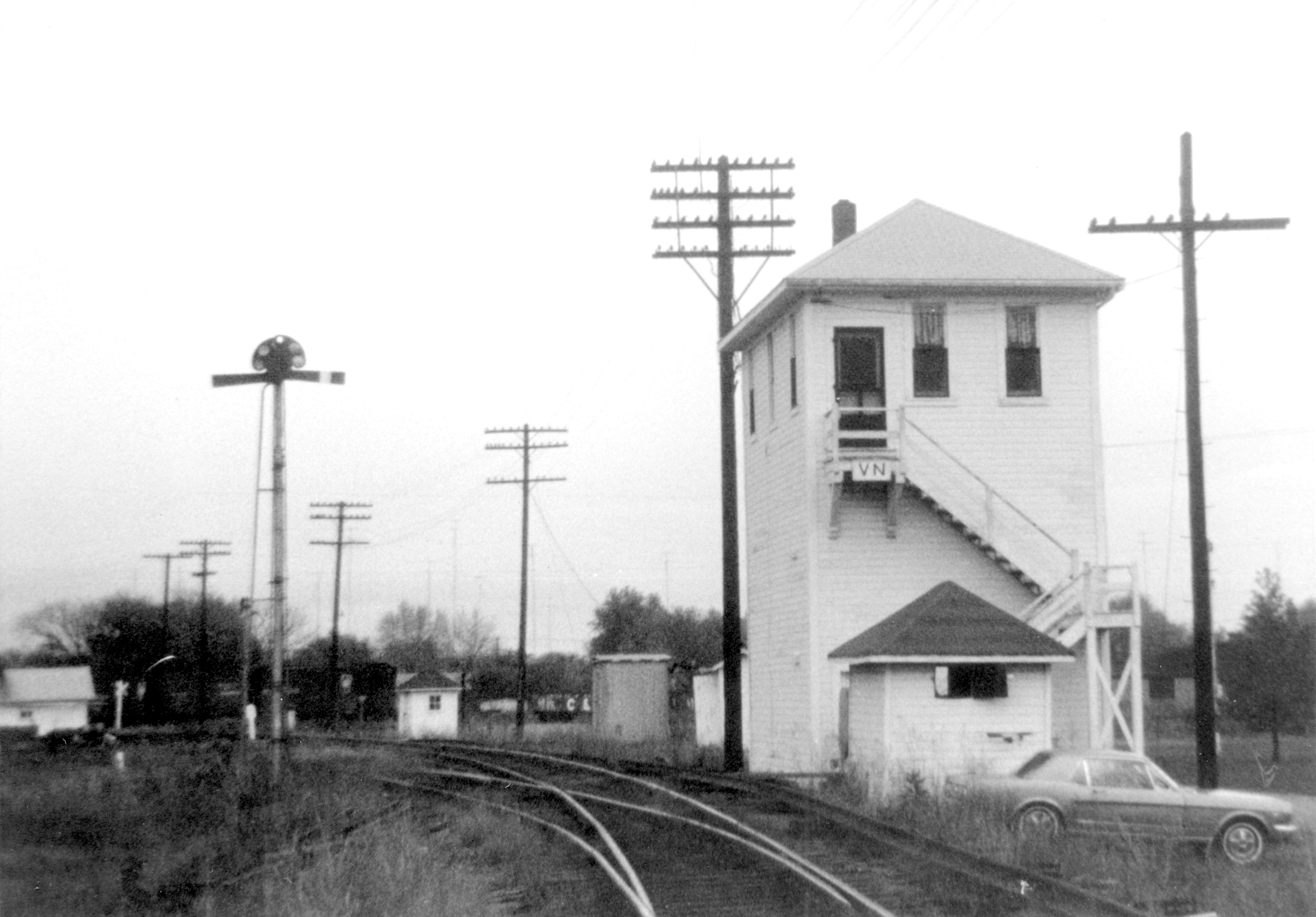
| Dennis DeBruiler commented on Roger's post I checked out a 1941 aerial photo because the tower should still be standing. I think the tower in the photo is along the UP/C&EI between NS/Southern and EVWR/L&N. Since the tower in the photo is on a slight angle, I think we are looking eastish with Southern on the left and L&N on the right. What was the name of that tower? David Cantrell VN Tower was built by C&EI in 1894. The tower in photo above must be the first one built at the location. David Cantrell VN Tower photo by Bill Grady from West Kentucky Chapter of the National Railway Historical Society. This tower is more square than rectangular as the one in the photo above. http://westkentuckynrhs.org/.../Bill%20Grady.../BGC004.jpg |
 |
| David Cantrell commented on Roger's post Mt. Vernon's coal mine - different owners |
 |
| David Cantrell commented on Roger's post 1908 Sanborn Map shows mine in relation to railroad. |
 |
| David Cantrell commented on Roger's post 1908 Sanborn Map detail for Imperial Mine in Mt. Vernon. Believe this configuration matches the photo above. |
 |
| David Cantrell commented on Roger's post 1913 Sanborn Map for Mt. Vernon Coal Mine shows different building arrangement. Looks like the old was torn down. Dennis DeBruler You know you are dealing with some serious history when a 1941 aerial is too modern. |
No comments:
Post a Comment