(
Satellite, the land has changed too much for me to determine the exact location.)
Today, the four locks that were in this town have been replaced by
Lock #17. When it was built in 1915, that 40.5' (12m) high lock had the highest lift in the world.
Cori Willson
posted two images with the comment: "Joshua Judson Gilbert's grain mill in Little Falls, dated 1864, was equipped with an overhead conveyor that brought grain straight from the Erie Canal boats to his mill to manufacture starch. The grain elevator was located between old locks 36 & 37, I believe that's today's Goat Island between the elevator and lock 37. When the Barge Canal was built the water level was raised significantly which created the small island."
 |
| 1 |
 |
2
1890s Enlarged Erie Canal map |
 |
SmithsonianMag, Library of Congress
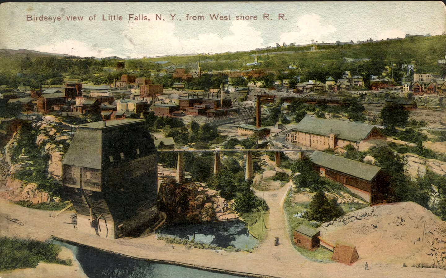
"In Little Falls, New York (pictured c. 1890), locks lifted boats more than 40 feet at the canal’s most difficult impasse."
|
 |
Little Falls NY Historical Society Museum commented on Cori's post
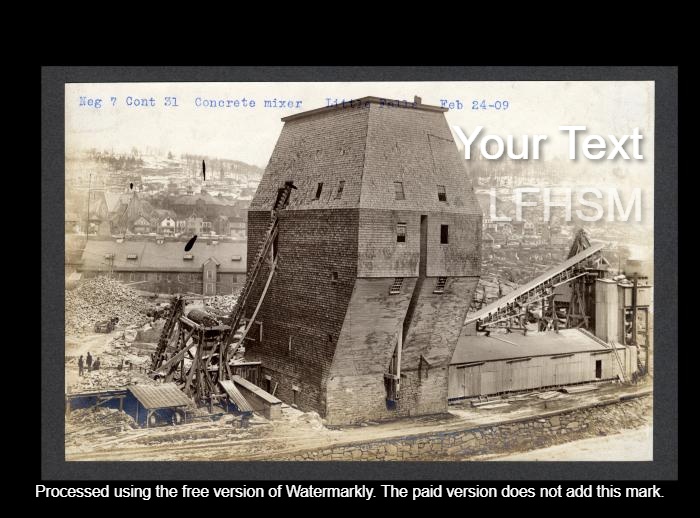
The Gilbert's Starch Elevator was used as a cement mixer during the construction of the Barge Canal | Circa 1909 |
 |
Cori Wilson commented on the above comment
I have that one too, progress photos from the State Archives:) |
 |
| Hudson River Lightkeeper commented on Cori's post |
Cori provided seven more images as comments on the second photo.
 |
| 1 |
 |
| 2 |
 |
| 3 |
 |
| 4 |
 |
| 5 |
 |
| 6 |
 |
| 7 |
 |
| The view provided by the link in the above comment by Chris |
 |
| Aaron Palmer commented on the second photo |
 |
Little Falls NY Historical Society Museum posted
Red Arrow- is the location of Lock 36, Green Arrow is the location of Lock 37, Blue Arrow- is the location of Lock 38, and Yellow Arrow- is the location of Lock 39 | Orange marks the Enlarged Erie Canal of 1862. |
 |
Little Falls NY Historical Society Museum posted
1811 Briggs Map | The Blue Arrows mark what became known as Loomis Island and the mile long feeder canal, which had a drop of 40 feet in elevation to harness waterpower for Colonel Peter Bellinger's Mill, which is marked on the map as "Mill" | The Red Arrows mark Seeley Island | The Green Arrows mark what became known as Moss Island | The Pink Dotted line marks the Route of the 1795 Western Inland Lock Navigation Canal, which followed the original path of the 1720s portage of the Little Carrying Place | The Yellow Dotted line is the proposed path of the 1825 Erie Canal. |
 |
| 1900/1900 Little Falls Quad @ 62,500 |


No comments:
Post a Comment