Andrew Shafer posted two photos with the comment: "Pond Creek Mine, Foresight Energy."
John Goroncy: I’ve never been there but wondering where the refuse/slurry areas are located?
Doug Moore: John Goroncy me too.
Scott Brown: They dump it where ever they want…..
Andrew Shafer: on top of the gob pile in the picture
 |
| 1 |
 |
| 2 |
 |
| Shane Wilkerson commented on Andrew's post Sugar Camp, its sister mine to the north. |
 |
| Dennis DeBruler commented on Andrew's post As of 2021, it has produced over 85 million tons of coal. https://wikiimage.isgs.illinois.edu/ilmines/webfiles/topo-mines/pittsburg.pdf Michael Westerhouse: Dennis DeBruler That's the old part of the mine. All sealed up now. |
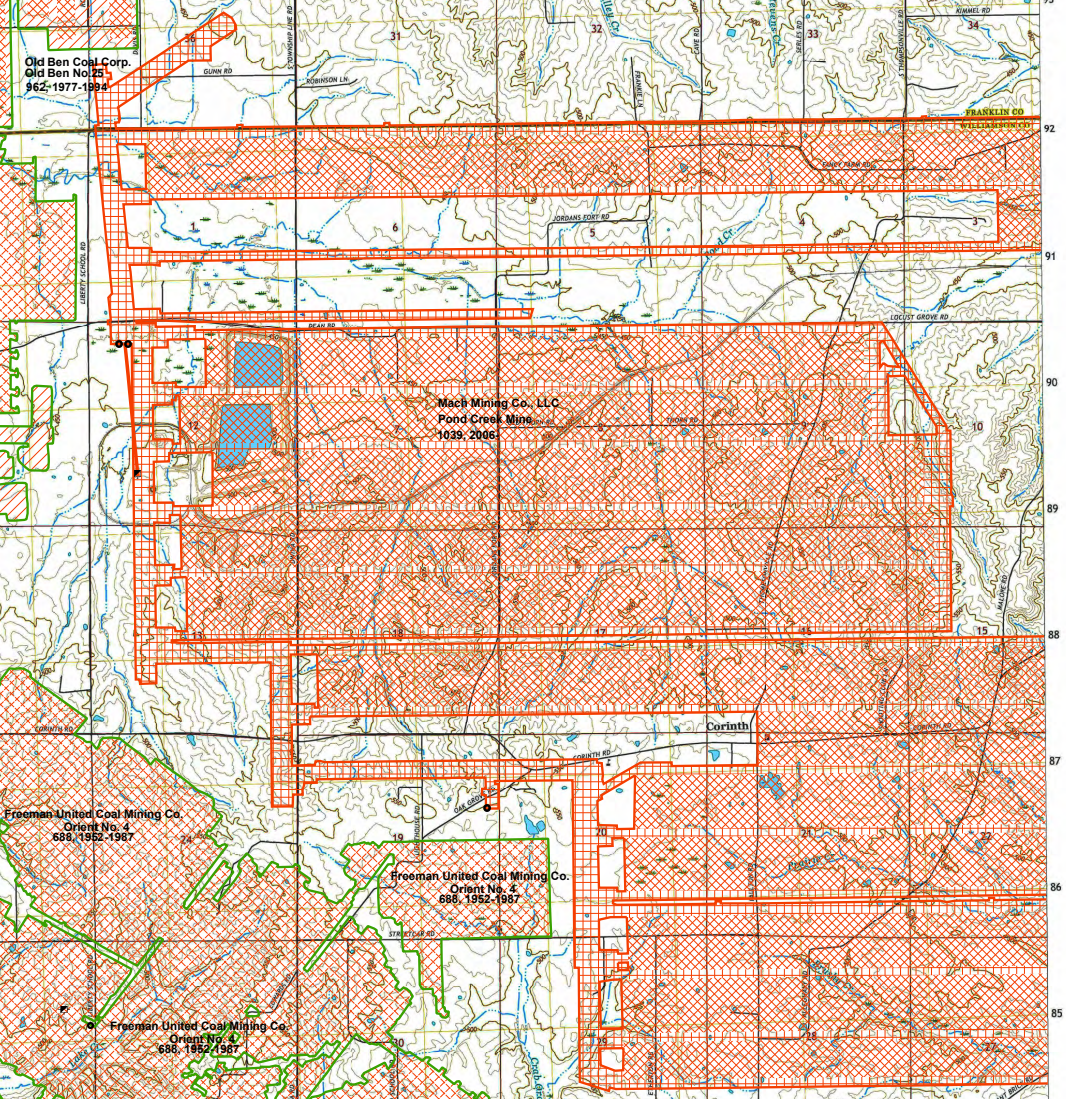
The mine is so new that the railroad that serves the mine doesn't show up on any topo maps nor my 2005 SPV Map. (The mine opened in 2006.) But a USGS map shows the spur that runs west of the CN/IC Edgewood Cutoff.
 |
| USGS |
I don't understand the comments about the waste areas. I thought it would be the rectangular "ponds."
 |
| Satellite |
When I saw the Google search results, I understood why there was interest in the waste management. Most of the results were about pollution complaints. I didn't dig too deep because the Sierra Club lost credibility in my eyes years ago with some of their complaints. But I did find that the mine uses a pipeline to dump wastewater into the Big Muddy River. And that water contains "high amounts of chloride." [SierraClub] While trying to find where the Big Muddy River is, I noticed that it meanders across a lot of Illinois land. The river passes this area between Zeigler and Freeman Spur. So the question is: how high is high amounts of chloride? After all, I've drunk chlorinated water since I was a kid, and I have swum in it. But care is taken to make sure the water has low amounts of chloride.
 |
| Road Map |
Foresight Energy calls this their Williamson Mine.
 |
| foresight |
No comments:
Post a Comment