 |
| James L. Ludwig posting A modest shack at Roxbury, Illinois ex Milwaukee Road depot on the branchline that served the St. Paul coal mine at Cherry and terminated at Ladd. [It continued past Ladd. See below. The St. Paul Coal Mine that I'm aware of is where the Milwaukee quit sharing the track of the NYC south of the Illinois river.] |
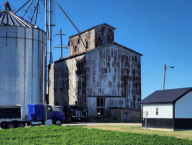
This is another railroad created town that has pretty well died except for the grain elevator. I include the powerline because that would be on the abandoned railroad property.
 |
| Street View, Jul 2023 |
Actually, the branch did not go to Cherry. It went on a straight line from south of Mendota to northeast of Ladd. According to the SPV Map, pp. 26 and 20, there was a branch off the branch that went North from Ladd through Cherry and terminated at St. Paul Coal Mine.
The branch from Mendota did not terminate at Ladd. Milwaukee continued Southwest from Ladd parallel to the Indiana, Illinois & Iowa (II&I) to Seatonville, including its own spur to the Seatonville Mine. It must have had trackage rights on the II&I until it headed east at Granville because I know it shared the II&I bridge over the Illinois River. From Granville, it ran east through Standard and Ceder Point until it got close to the IC Gruber line and turned north to terminate in Oglesby where it could tap the cement manufacturing industry of Buzzi Unicem and Lehigh Portland.
The St. Paul Mine must have been rather small because Milwaukee bought the Chicago, Terre Haute & South Eastern to gain access to the coal mines in southern Indiana.
 |
| Bill Molony posted |
Stuart B. Slaymaker Lots of coal on them thar branches. Oglesby, and especially the south end of the C.T.H. & S.E...
Item F on the map confirms that Milwaukee used trackage rights over the CIS/II&I between Seatonville and Granville. In fact, it used their branches to DePue and McNabb as well.
Update: The map shows the segment between Cherry and St. Paul Mine was already abandoned by 1944. See Milwaukee's Cherry Depot for more details on the subbranch.
Also, see Oglesby for more information on the southern end of this branch.
A map is worth a thousand words.This map helped me understand why Milwaukee went through Rochelle and Mendota. It was the branch that accessed coal mines. (This map is also another example of a topo map using the Burlington Northern name long before the company even existed.)
 |
| 1958 Aurora Quad @ 250,000 |
Wesley Peters posted three photos with the comment:


No comments:
Post a Comment