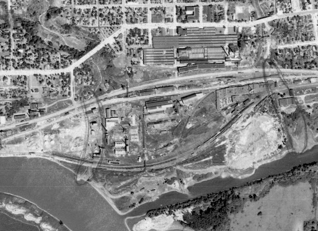
RI Depot: (Satellite)
IC Depot: (Satellite?)
RI Roundhouse: (Satellite)
CB&Q Roundhouse: (Satellite)
 |
| Andy Zukowski posted Rock Island Railroad Depot in Peru, Illinois. C1910 Richard Fiedler shared |
Later, the Rock Island served Peru with their LaSalle Depot.
 |
| Anthony M Miranda commented on Andy's post via Dennis DeBruler |
 |
| 1939 Aerial Photo from ILHAP |
 |
| 1916 Sanborn Map, Sheet 10 |
 |
| 1939 Aerial Photo from ILHAP |
 |
| 1926 Sanborn Map, Sheet 11 |
 |
| 1926 Sanborn Map, Sheet 13 North is to the left |
I found the coal chutes for both railroads on Sheet 12 of the 1916 map. They are both next to a tramway that goes 25' to 30' high over the railroads from the Carbon Coal Union Shaft towards the river. But I could not find that tramway on the 1939 aerial photo. According to the map, the tramway was to carry waste away from the mine. But I wonder if it was also used to put coal in the railroad chutes.
 |
| 1939 Aerial Photo from ILHAP |
 |
| William Wozniak posted Rock Island Roundhouse...Peru,IL...rt 6 directly behind photgrapher...(RT jr photo credit) Sam Sandoval That Was A Cool Place & Long After the Steam Enigines Left The Diesels Took Over The Roundhouse , Mark Baker Wow! Where was this in relation to Peru's river front today? Dennis DeBruler I believe it was in this clump of trees: https://www.google.com/.../@41.3272293,-89.../data=!3m1!1e3 |
 |
| Andy Zukowski posted Illinois Central Railroad Depot in LaSalle, Illinois during the 1920s John Czerwinski shared Jim Kelling shared LaSalle/Peru, Illinois (Illinois Central station) |
Andy Zukowski posted three photos with the comment: "3 different images of Railway Roundhouse at Peru, Illinois. Early 1900’s."
Terry B. Carlson: I've found the Sanborn Fire Insurance map and the approximate location in Peru. But, it's "approximate".
 |
| 1 |
 |
| 2 |
 |
| 3 |
 |
| The map referenced in Terry's comment |
 |
| Dennis DeBruler commented on Terry's comment Evidently, East Street was renamed as Pine Street. https://maps.app.goo.gl/Yq5ksJS3G6roQotZ8 |


.jpg)


.jpg)


