Showing posts with label abanEgypt. Show all posts

Tuesday, May 12, 2026

Mound City, IL: CGB & ADM Grain Elevators, IC Depot and Old Gas Station in Mounds, IL

CGB: (Satellite)
ADM: (Satellite)
IC Depot: (Satellite)
Big Four Depot, Original: (Satellite?)
Big Four Depot, Current: (Satellite)
Old Gas Station: (Satellite, this is in Mounds, IL.)

The CGB elevator is on the left, and the IC Depot is on the right. In the center background is a remnant of its downtown.
Street View, Nov 2025

A closeup of that downtown remnant.
Street View, Nov 2025

Big Four Depot


Andy Zukowski posted
Big Four Railroad Depot - Mound City, Illinois— Photo by Brent Moore
Bill Edrington: It was moved a few blocks at some point to a lot on Merritt Court between High and Pearl Streets, where it became a private home. Until today I had no idea it still existed. But it‘s unmistakably a Big Four depot.
Richard Fiedler shared

Dennis DeBruler commented on Bill's comment
https://maps.app.goo.gl/Yiw469FidxaSp23Y6

Larry Candilas commented on Andy's post
MP 252.7 NYC Egyptian Line


Both of the Mound City elevators are rail-to-barge.

CGB:
Street View, Nov 2025

ADM:
Street View, Sep 2023

I see that CGB has a couple of big grain piles. 
Satellite

This confirms that the railroad along the river was the Big Four's Cairo or Egypt line. But that railroad was abandoned a while ago. So how do the trains get to the elevators? This map shows that there was a shortline that provided access to the Illinois Central. And a satellite image shows that that route is still intact to the CN route.
1953/59 Cairo Quad @ 62,500

I could not find the Big Four Depot. But I noticed that CGB evidently tore down some houses to build their elevator. Although, looking at a satellite map, this town has lost a lot of houses.
1959 Aerial Photo from ILHAP

Roger Kujawa posted eight photos with the comment: "Mound City, Illinois; Illinois Central depot and ADM SW1001 locomotive."
Roger Kujawa shared
1

2

3

4

5

6

7

8

Roger Kujawa posted five photos with the comment: "Mound City, Illinois.  Consolidated Grain and Barge locos at the north end of the plant. There is a switcher and another GP locomotive in one of the plant buildings."
Roger Kujawa shared with the same comment.
1

2

3

4

5
.

Old Gas Station


While checking out the nearby Mounds, IL, to confirm that they still have some stores or residents in Mound City, I found this old gas station. This is on the original US-51 route.
Street View, Nov 2025

The diamond above the garage door reminded me of Sunoco. But that doesn't fit. So I don't know what brand this station pumped.
1000logos

Thursday, September 18, 2025

Georgetown, IL: Lost/Big Four (Cairo Division) Depot

(Satellite)

Kimberly Rose posted
Georgetown, Illinois

Larry Candilas commented on Kimberly's post
A few years later (6-15-80) looking not so prosperous anymore.

Dennis DeBruler commented on Larry's comment
The silos are extant. That confirms that the depot was in the northeast quadrant of West St. and the vegetation line for the tracks. https://maps.app.goo.gl/jg2gqjWfDT4V7b1U7

1940 Aerial Photo from ILHAP


Wednesday, August 20, 2025

West Union, IL: Lost/NYC/Big Four/Egyptian LIne Depot

(Satellite, according to the aerial photo below, Depot Street was built on the railroad's RoW.)

Tanith Harley posted
Hi All. I am researching the New York Central Line (Chicago to Danville ?) that went through West Union, Illinois in the 1920s. In particular looking for the Big Four map / timetable for West Union station in 1925-1926. Can anyone please help? 
Photo of West Union, Illinois Big Four Station for reference. 
Thank you all so much!
Bill Edrington: Kendel Robinson - The line between Danville and Cairo was part of the Big Four and was considerably older than the line between Indiana Harbor and Danville, which was part of the Chicago, Indiana & Southern, a subsidiary of the NYC-controlled Lake Shore & Michigan Southern. Both the LS&MS and the CI&S were merged outright into the NYC in 1914, but the Big Four, while under NYC control, was not. The Indiana Harbor-Danville line was built soon after the turn of the 20th century, primarily to handle northbound coal from the newly developing mines in the Harrisburg district, and the portion of the Big Four‘s Cairo Division between Danville and Harrisburg was heavily upgraded at that same time, including the construction of Lyons Yard. The CI&S/NYC did operate local passenger trains north of Danville for a number of years, in addition to a through overnight Cairo-Chicago train in conjunction with the Big Four. I believe the Cairo-Chicago train was shifted back to its traditional C&EI route north of Danville by the USRA, a federal agency that took control of the railroads during World War I. The train continued running on the C&EI for several years after USRA control of the railroads ended, for some reason. I do know that it permanently shifted back to the NYC route through Sheff, Kentland and Schneider by 1927, though, because by then the “Egyptian” was running as a through train from La Salle Street Station in Chicago all the way to Cairo, including an Evansville section that operated over the Big Four’s EM&N Branch from Mt. Carmel to Evansville, in direct competition with the C&EI. Hope that helps.
Dennis DeBruler: This webpage has some maps. http://madisonrails.railfan.net/big4memories3.html

1939 Aerial Photo from ILHAP

None of the street view drivers got off IL-1 and covered this town. So I can't get any good views of the elevator.
Satellite

Friday, August 15, 2025

Wabash C: Keensberg, IL: 1970-2007 Wabash Coal Mine

(Satellite)

Larry Joe Jenkel posted, cropped
Wabash Mine
Gary O Mcdaniel: Coal was shipped directly from Mine to the power plant across the Wabash river, without being cleaned.
I remember when inspecting the mine, power plant complained about debris in coal...rock dust sacks etc
Tommy Clark: Gary O Mcdaniel run of mine until Washer was built in 80s. PSI threatened to send our coal back if we didn't wash it. Hard to do quality control at the face on units with soft, muddy bottoms and bad top.
Gary O Mcdaniel: The work force at the mine was unique to say the least. One section had all women.

Larry Joe Jenkel posted, cropped

Larry Joe Jenkel posted, cropped

You can still see the remnants of the industrial spur and the loadout loop.
Satellite

Directory

Map

It is very disconcerting that the ISGS topo map is so incomplete.
Keensburg Quad

The industrial spur came from the NYC/Big Four Egyptian Line. Norfolk Southern served the remnant of the Egyptian Line that went from their former Southern tracks to that spur until the mine quit operating.
Dennis DeBruler

Sunday, February 23, 2025

Saline C: Ledford, IL: Saline County Coal Mine #1

(Satellite, if there are any traces of the tipple, the trees have long covered them up)

Roger Kujawa posted
1909 RPPC Saline County Coal Mine #1 At Ledford, Illinois

Dennis DeBruler commented on Roger's post
It was index 3290.

Dennis DeBruler commented on Roger's post
The Tunnel Hill State Trail makes it easier to find because the tipple (bold 3290) would have been along the Big Four's Egyptian Line.
https://www.google.com/maps/@37.6990833,-88.5859323,132m/data=!3m1!1e3


Sunday, October 1, 2023

Saline C: Harrisburg, IL: Sahara/O'Gara Coal Mine #1

#1: (Satellite, most of the tree covered area.)

Sahara/O'Gara #12 was just a little southwest of here. And remnants of its tipple are still standing.

SouthernIllinoisRailroads
Harrisburg Sahara Mine #1
Harrisburg City Building

A view of the other side of the tipple.
Roger Kujawa posted
K17/ Harrisburg Illinois Postcard c1940s Sahara Coal Mine Washery 326

Directory

Map

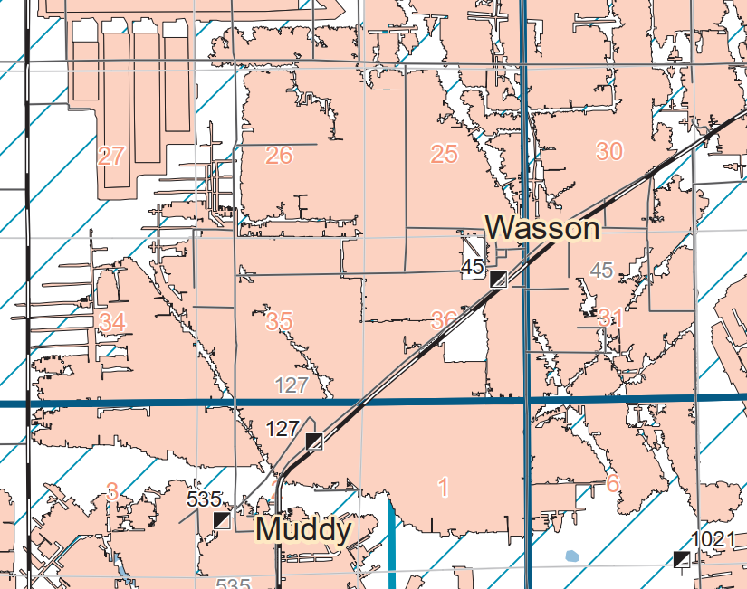
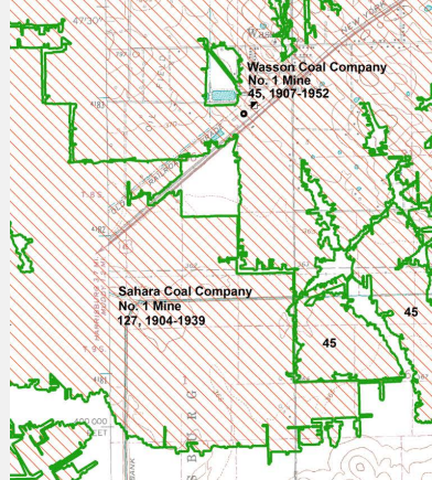
I included the town of Wasson in the upper-right corner to help correlate this photo with today's satellite images. The mine is on the left side of this excerpt.
1938 Aerial Photo from ILHAP