Tuesday, August 10, 2021

Albert Lea, MN: Milwaukee and M&StL Depots, Railroad Hub and new Oat Mill

Milwaukee Depot: (Satellite)
C&NW/M&StL Depot: (Satellite)
Oat Mill: (Satellite, currently it is a green field)

Tom Nelson posted
C.M. & St. P. Depot, Albert Lea, MN. 1916.

A Tom Nelson URL

A Tom Nelson URL

Mark Llanuza posted
Its 1983 a view at the former M&STL station at Albert Lea Min steam 1385 (photo collection Mark Llanuza )
 
Street View, May 2023

Jim Murphy posted
For an unknown reason on January 16, 1983, No.161 came down from St. Paul on the xM&StL side instead of using the xRI as normal. Orders were being handed up  before setting out one unit and 49 grain loads in Albert Lea, MN the yard.

Chicago & North Western Historical Society posted
The yard at Albert Lea MN looks rather empty, there is a north bound train in the distance with CNW 252, 325, & 240.  Soph Marty photographed this scene November 16, 1974.  32196

Albert Lea was a significant railroad hub. Milwaukee, Minneapolis & St. Louis (later C&NW) and Rock Island all had three spokes meeting here. And IC terminated here.
1954 Albert Lea Quadrangle @ 1:62,500

The route to the Southeast was shared by C&NW/M&StL (yellow), Rock Island (green) and IC. (I did not include a color for IC because I don't know where it terminated in the city.) Milwaukee is blue.
1954 Albert Lea Quadrangle @ 1:62,500

Today, Dakota, Minnesota & Eastern (DME) shares the southeastern route with CP and UP. UP chose the RI to the Northeast and DME has the C&NW to the Northwest. The Southwest spokes for both the RI and C&NW are now abandoned. The branch of the Milwaukee turning Northwest on the west side of the town is also abandoned.

John Harker posted
A C&NW south bound freight with SD40-2 6890 leading was just about to cross the diamond with the Milw in Albert Lea, MN on January 24th, 1984. The diamond was just east of South Newton Ave, This scene with the interlocking tower looks to the northeast. The C&NW freight was traveling on the Spine Line or the ex Rock Island Short Line. Mark Simonson captured this scene. John Harker editing and collection
Bob Johnson: Unless something has changed, that Tower is still there, but it is a Signal Maintainer Office. It was in the list of structures to be torn down at least 5 or more years ago, but I don't know the current status.

Dennis DeBruler commented on Bob's comment
The tower is there as of Aug 2023, but many of the windows are broken.   https://maps.app.goo.gl/cDQ9LVkfi8sHts8VA

John Harker posted
C G Wallenmeyer captured this scene with a RI south freight being pulled by GP38-2 4317 and GP18 1352 at Albert Lea, Minnesota in April 1978.  The train was just about to cross the RI / Milw diamond near the tower.  This view from South Newton Avenue looked to the northeast just south of downtown.  And it must have been a rainy, overcast day.  John Harker photo editing and collection.

John Harker posted
Mike Guss captured C&NW C40-8s 8506 and 8515 with their south bound empties about to cross the ex Milwaukee at Albert Lea, Minnesota on February 28, 1993.  This image was scanned from an original Kodak Kodachrome slide.

Ted Gregory posted two photos with the comment:
The more I look at this picture, the more intriguing it becomes.
First, there aren't too many places, that I am aware of, that the Milwaukee Road crossed the Rock Island. But in the confines of southern Minnesota, you find such an interlocking.
The two railroads today are the UP (Rock Island) and CP (ICE nee-MILW).
Second, On this date, my last visit to the site, June 10, 2020, there is an interlocking tower still standing.  I wonder if it is still there today?
Third, the shape of the tower- particularly the narrowness- is stunning.
Fourth, the angle of the diamond is unique. 
Lastly, what is up with that signal guarding the siding? Looks like there is only one absolute for NB moves. But there has to be two signals SB as the diamond must be controlled.
I am trying to figure out the heritage of the tower. I am assuming its Rock Island, since it looks like the UP controls the interlocking today.  (Control Point identifier seems to mimic other locations on the UP system.)
CP U252 
Albert Lea
June 10, 2020
Trenton Dominy: The interlocking tower is indeed still standing and was manned by the Rock Island.
The reason why it still exists is the Union Pacific which took over the rock Island tracks from Chicago and Northwestern in 1995 uses it to protect its crossing electronics.
1

2
.

Green Acres Oat Milling


Landon Plagge posted six photos with the comment: "A few update pictures of the oat mill we are building in Albert Lea MN with 130 other farmers."
1

2

3

4

5

6

KIMT
I saw a price tag of $40m in another source (kaaltv), but it is now up to $55m.

Aug 12, 2026:
Green Acres Milling posted two photos with the comment:
Oh hi! We've been a little busy over the last year. In August 2025 we were placing the forms for concrete, and just look at us now!
The Green Acres Milling vision is coming to life and we can't wait for our oats to make their way to your tables this fall!
We are not currently accepting additional oat growers, but if you have final product inquiries you can reach us here: sales@greenacresmilling.com
To learn more and join our team: https://greenacresmilling.com/careers
Landon Plagge shared with the comment: "4 million bushel annual capacity for cleaning, kilning, and milling oats into flour and flakes.    6 hopper bins are 24’x80’ and hold about 30,000 bushel of raw oats each.   95 metric ton per hour receiving and cleaning."
1

2

GreenAcresMilling_facility
"Everything from our six custom-built Meridian storage bins to our pneumatic conveying systems ensures we have thorough clean-outs between product runs."

GreenAcresMilling_facility
"We have three of the world's most-advanced optical sorters and 17 integrated process scales to deliver the utmost product purity while tracking valuable operational insights."


Monday, August 9, 2021

Fordyce, AK: Rock Island Depot and Railyard

(Satellite)

The Rock Island was the north/southish railroad through town. It is abandoned north of town, but the Fordyce & Princeton Railroad owns the southern route down to Crossett, AR. The east/westish railroad was the St. Louis Southwestern Railway (SSW). The SSW was known as the "Cotton Belt." It was a subsidiary of Southern Pacific, and it is now used by BNSF and UP.

Street View

Mike Sypult posted
Fordyce on the Rock Island - then and now 110 years later!

Mike Sypult shared
Keith Partlow: Its amazing to think at one time, the railroad depot was the most important building in a town. It was the life line to the rest of the world.

While looking for the depot, I noticed that the little railyard is still used.
Street View

Satellite


Janesville, WI: WSOR/Milwaukee Roundhouse and Lost Depot

Roundhouse: (Satellite)
Depot: (Satellite)

WSOR = Wisconsin & Southern

JustinKreklow posted
The Milwaukee road roundhouse in Janesville WI built back in 1905 still stands and is used by the Wisconsin &Southern railroad 7/10/21
[Note the grain elevator in the background.]
 
Sam Carlson commented on his post
96A on turntabe at Janesville on Aug.7, 1990.
[Some comments indicated that this is the last F that they owned, and it is now on the ELS (Escanaber & Lake Superior Railroad)]

Street View

I presume the plant in the lower-right corner was the GM plant that used to make pickup trucks before GM built a plant south of Fort Wayne to make them.
1961 Janesville West Quadrangle @ 1:24,000

EarthExplorer: Apr 26, 1955 @ 17,000; AR1VDG000100032

Dave Martens posted four images with the comment: "Jim Swanson asked about images of the Milwaukee Road depot in Janesville. Not many photos of this depot seem to be widely available - possibly explaining Jim's question."
Tom Moe: Was it near 11& 51?
Jim Kelling shared with the comment: "Janesville Wisconsin (Milwaukee Road)/"
1

2

3

4

Dave Martens commented on his post
I believe that the Janesville depot was where the parking lot, shown in this image, now stands (the blue marker shown there)

Dennis DeBruler replied to Tom's question
It was between Academy and Jackson Streets on the west side of the tracks. (1955 aerial photo)
[AR1VDG000100032]


Sunday, August 8, 2021

Walkerton, IN: NKP, B&O and NYC/CI&S/II&I Depots

(Since none of the depots exist today, I used the topo map at the bottom instead of satellite locations.)
Carl Venzke posted
"Sometime between 1946 and 1949, Nickel Plate 2-8-2 #669 was northbound past the Walkerton, Indiana depot. Notice the rider car behind the tender; this was used for an extra brakeman (also called listman) and LCL freight. Also notice the white pilot truck wheels, this is an indication that the wheels had recently been checked for cracks. Photo is courtesy of M. D. McCarter Photographs"

The track going from the northwest to the southeast was the NKP by 1928. It was built by the Lake Erie & Western. We can tell by the angle of the street grid that this was the first railroad through the area and that this railroad caused the town to exist. The east/west tracks were the B&O. The track from the southwest to the northeast was the NYC ny 1928. But it is sometimes referred to by its predecessor corporate names. It was built by the Indiana, Illinois & Iowa. Then it became part of the Chicago, Indiana & Southern, more commonly known as the Kankakee Belt. Then the NYC bought it. The NYC tracks were abandoned by Conrail in 1982, and they have been removed. But the B&O tracks still exist as the mainline of CSX, and the NKP/LE&W track is now operated by the Elkhart & Western Railway.
1958 Walkerton Quadrangle @ 1:24,000

Hoosier Valley
"The date of the photo is probably in the 1910s or maybe a little earlier. There are a lot of buildings in this picture and most are railroad related. From left to right: the B&O depot, don’t know about the building behind the depot, next is a small building at the crossing of the CI&S and LE&W, The CI&S water tank, next is a CI&S and LE&W transfer house, the next building is possibly a B&O and CI&S freight house, then the three story tower, a crossing watchman shanty, the CI&S depot and across the tracks is, what I assume, is a section house. Today, of all these buildings only the tower remains and it is now two stories tall. The Chicago, Indiana & Southern is also gone. Postcard is from the Bob Albert collection."

Raymond Storey posted

I am very disappointed by this topo map. The black rectangles are supposed to indicate the locations of buildings in 1958. But since the Junction Tower still stands, we know there should be a rectangle in the triangle made by the three railroads. I marked that triangle with a yellow circle. By using a 1956 aerial photo, I found the location of the B&O (blue line over the word "Gas") and NYC (orange line) depots that were west and south of the junction.  I'm not as confidant, but I think the NKP depot is now the parking lot that is south of the tracks and east of Illinois St (green line). The grain elevator in the background of Carl's post is consistent with the aerial photo.
1958 Walkerton Quadrangle @ 1:24,000 plus Paint


Saturday, August 7, 2021

Was Grinnell, IA: MSTL and Rock Island Depot

If you are here because of "Grinnell, IA: MSTL and Rock Island Depot," then you need to go there.


Friday, August 6, 2021

Beaumont, KS: Frisco Water Tower and Depot

Tower: (Satellite)
Depot: (Satellite)

Richard A Boyd posted seven photos with the comment: "This wooden water tower, identified as the only one like it still in existence, is located along the old (abandoned) Frisco (St Louis & San Francisco Railway) right-of-way in Beaumont, Kansas. Beaumont is just off of US-400 east of Wichita Kansas."
Dennis DeBruler shared
1

2

3

4

5

6

7

Facebook comments
Centrailia link
Kinmundy link
Street View link

Naturebug Photography posted two photos with the comment:
Beaumont, KS
Beautifully restored Train Station and Last Frisco Water Tower still standing(1885).
1

2

Darryl Robert posted two photos with the comment: "The last frisco water tower still standing at beamount ks"
1

2
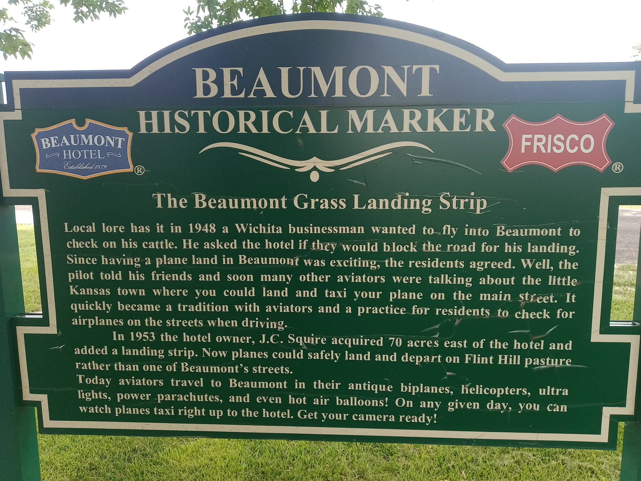
[Using Street View, I noticed there are some more of these green historical markers. But I wasn't able to read them.]

Depot


Street View, Dec 2023

Richard Crabtree posted four images with the comment:
Here we are at the Frisco Depot in Beaumont Kansas.
The surrounding area is farm land, settled by ranchers and farmers after the Civil War. Homesteaders from Missouri, Iowa, Tennessee, and other eastern states came because of an abundance of cheap land.
The town site was first a stop on the stagecoach route between Fredonia and Wichita. In 1879 Edwin and Emma Russell built the Summit Hotel, later renamed as the Beaumont Hotel.
In 1885 the St. Louis and San Francisco Railroad, better known as the Frisco, established Beaumont as a railroad town. One line of tracks ran east and west, connecting St. Louis with Wichita.
A spur was added later going south from Beaumont though Latham and on to the Oklahoma border. A roundhouse was built in 1890 across from the Summit Hotel, and employed 90 people. The water tower, built in 1885, stands across from the hotel and is on the National Register of Historic Places. Because of the rich bluestem grass, the area was used as staging area to ship cattle back east.
Photo 1) Frisco Depot in Beaumont Kansas with Frisco No. 1000 4-6-2 Pacific Class built by Brooks Locomotive Works in 1904 Frisco Depot in Beaumont Kansas circa 1910
Photo 2) Frisco Depot in Beaumont Kansas circa 1910
Photo 3) Beaumont Kansas & Frisco Depot Map 1886
Photo 4)Frisco Depot in Beaumont Kansas Floor plan ~ MSU Digital Library
Jim Kelling shared with the comment: "Frisco Lines depot in Beaumont Kansas."
1

2

3

4