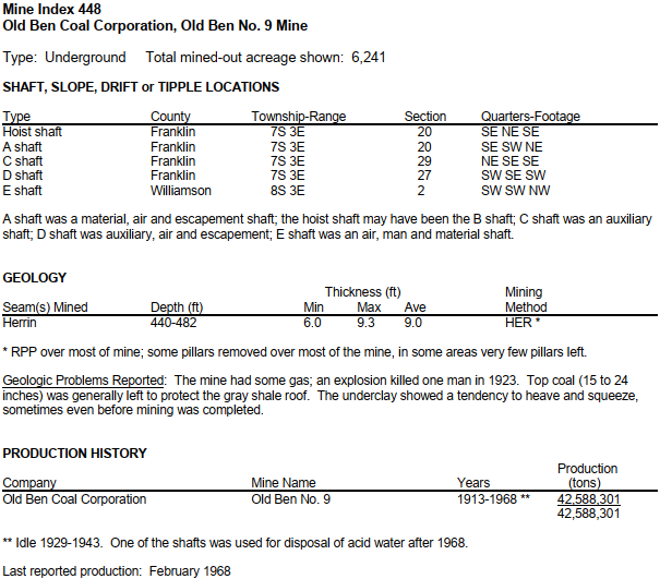
 |
| TheSouthern, photo 12 of 27 The story that accompanied this photo, published in The Southern on Feb. 15, 1968, reads: "Old Ben Coal Corp. mine No. 9 at West Frankfort, the oldest operating deep shaft coal mine in Illinois, has closed down effective today, company officials announced. The last shift at No. 9 finished working at midnight Wednesday. The mine, which employes 311 men, closed because of 'the greatly changed character of present coal markets and the ever-increasing costs of underground mining in over-age properties,' according to a press release issued by Old Ben." TheSouthern Larry Joe Jenkel posted |
 |
| Dave Durham posted Old Ben Coal Mine 1920s, West Frankfort, Newberry Library, Chicago and the Midwest [I presume this is #9 instead of Old Ben #8.] |
 |
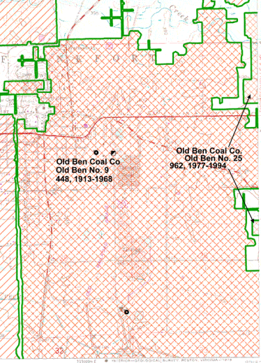
| west-frankfort from counties, p19 |
 |
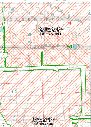
| west-frankfort from counties, p i, 290% |
 |
| johnston_city from counties, p i, 80% |
 |
| 1938 Aerial Photo from ILHAP |
The railroad coming in from the north was an IC branch. The railroad coming from the west was a CB&Q branch. The railyard we see in the old aerial on the west side of #9 was the Cambell Yard. It was jointly owned by CB&Q and IC. You can easily trace the abandoned IC branch north because it was straight and there are a lot of treelines left. The branch joined a still existing CN/IC branch near Muddy River.
It is a good thing that someone did not allow development over the HER mining area because it looks like there have been several more areas of subsidence.
 |
| Satellite |
No comments:
Post a Comment