Saturday, September 12, 2020

Gibson C: Lynnville, IN: Peabody Somerville Mine and Big Kate Dragline (B-E 2570)

(Satellite, when published)
(Satellite, Dec 2024)

The loadout is in Gibson County, but the pit is now in Warrick County.

This pit that is north of I-64 must be the Barren Fork Pit of the Wild Boar Coal Mine. [CoalZoom] I think the initial part of the Wild Boar Coal Mine was south of I-64.

This mine had an active dragline. But according to comments on a comment by Bradley Robinson on his Facebook post, Big Kate was parked a year ago [2019] and it is in bad shape. It is being used as a parts machine for draglines at Bear Run, which has 3 draglines. ''2 are in service and one is being parted out. 2 2570's 1 2550" [William Shane Keller's comments on a post]
(Mar 2022 Update: Big Kate was restored and it started running again on Mar 1, 2022. It is the only big iron that is still running in Warrick County. At one time there were 13 big machines in the county. [1:22 video])
Steele Lytle commented on a post

<update>
Dec 2024:
Note that Michael called this the Somerville Mine. This is why I changed the title from Wild Boar to Somerville.
Some comments on a post
[Indeed, Kate is just a little Northwest of the Museum of the Coal Industry.]

Mar 2026:
Mining #Shorts posted
Big Kate is one of the largest walking draglines ever built for coal mining in the United States.
Constructed in 1971 by Bucyrus-Erie as a 2570 model, it went to work in southern Indiana at Peabody’s Somerville mine.
It featured a bucket capacity around 120 cubic yards, placing it in the upper range of draglines built during that period.
Its boom is 300 feet long, exactly 100 yards (same as a short Par 3 hole, for all golfers out there!).
Big Kate got her name after workers wrote their wives’ names on a piece of paper and placed it in a hard hat. After shuffling, the name Kate was drawn. She remains at the site 55 years later.
Over the decades, Big Kate experienced the ups and downs of the coal mining industry, including extended shutdowns and even threats of being scrapped.
The dragline was returned to service a few years ago after a long hiatus, but it is now reportedly idle once more.
She'll make it!
</update>

Satellite

The 1360 Experience posted
This is a picture of BIG Kate the Bucyrus Erie 2570W Dragline being built on the erection pad. She is special because she was lot # 1. This machine was named after the president of Old Ben Coal's wife, Katherine.
 
The 1360 Experience posted

The 1360 Experience commented on their post

The above closeup is highlighted in the lower-right corner of this image of the mine. It appears it may be parked because the mine has reached County Road 1025S and it ran out of land to strip.
Satellite
Screenshot
Peabody Coal in Eastern Gibson County... Big Kate soon to go back to work.
This video was posted by GCNT as The Last Days of Big Kate in 2019. Since then the doors have been welded shut and big Kate has been idle for months but soon we hear this giant piece of machinery one of the largest in the world will go back to work digging up coal.
Big Kate has been digging coal since 1971 and is one of the last remaining dragline of its size. Why the name BIG KATE well she does weigh 10.5 million pounds and can carry loads of more than 500,000 lbs in her bucket. If you put a roof on her bucket it would make for a nice 2 car garage.
Pictured in comments is Big Kate today Nov 11 as she sets in Eastern Gibson County also some great drone footage in comments section from a young man who traveled from Illinois a few weeks ago to get some footage.
VLloyd GCNT 11/11/21
[There are several stills of Big Kate in the comments. The Nov 5, 2021, 8:00 long drone video mentioned in the above comments.]

Earthmover Legends posted
Big Kate 2570W Walking Dragline Towers Over the Mine Site
The legendary Big Kate 2570W walking dragline shows just how massive these machines truly are. Its enormous boom structure, machinery house, and heavy-duty walking system were built for large-scale overburden removal where conventional excavators simply couldn’t match its reach and capacity.
Have you ever seen a 2570W walking dragline this close?

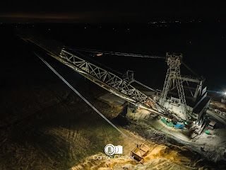
Carlton Crasher Photography posted eight photos with the comment: "Big Kate as this dragline is dubbed has a new lease on life with coal prices up for now. Undergoing repairs  before it can be put back to use since it’s parking in 2019."
Anthony Quinn: Where is Kate at these days? My dad operated her 20+ years ago.
Carlton Crasher Photography: Anthony Quinn Dropped pin https://goo.gl/maps/uFb6WtqCYcP4jNvA6. Within the next year she is reported to be working where she is then walked across I-64 to another mine in warrick county.
Museum Of The Coal Industry shared
Michael Smith: May go south to 7 hills mine.
1

2

3

4

5

6

7

8

The 1360 Experience posted
A great view of Big Kate.
Jerry Louis Karr: Not lackin lube on those sheaves and cables!
[I had to look for a while before I decided that the photo was taken from the end of the boom. It is looking backwards towards the mast, the gantry and the top of the house.]

The 1360 Experience posted two photos.
1

2

Noah Emerson Chappell commented on Carlton's post
Got to see here last weekend thanks to a friend of mine, William Crupper.

1 of 10 photos and a 1:44 video posted by Darald W. Earles with the comment: "Big Kate."

cropped screenshot from 2nd of 3 videos
Mike Dicenzo: She is pretty close to the bank !
Ryan Yager: Mike Dicenzo 😬yes it is.
Alex Taylor: Thomas Kagerbauer that sound of the chains and rigging while it digs, and then the sounds of the house fans as it turns around to dump!

Nate Nowak shared a post of 20 photos: ""Big Kate" B-E 2570W yesterday [Aug 15, 2022]. Unfortunately I didn't get to see her dig much, they had to shut down because it was too dusty. Peabody South Somerville Mine, near Lynnville, IN"

Nate Nowak shared a post of 12 photos: "Big Kate 2570 dragline from the other side of the pit, Peabody South Somerville Mine, near Lynnville, Indiana."

safe_image for 4:26 video

Heavysteelmarvel posted 1:03 video
Big Kate: Indiana's Famous Walking Dragline

Kevin Anderson posted three photos with the comment: "Stopped to see Big Kate today [May 15, 2026]."
Nicholas S Koba Jr.: I hope they get her digging again.
Kevin Anderson: Nicholas S Koba Jr. I need to go out at night and take pictures she was all lit up today can’t see all the light on in the picture but was awesome to see.
1

2

3

The description is AI babble, but the photo looks legit.
Konstruksi Berat posted

Comments on Konstruksi's post

This photo is not legit, but it is interesting.
Konstruksi Berat posted
Jeri Casson: That is one of the Armstrong 752 Page machines. I'm not sure why this showing up on my feed, but anything this site posts must be taken with a grain of salt. They are mostly inaccurately identified photos or simply AI graphics.
[I blocked that account.]

Facebook Reel

Facebook Reel

1:09 video of Big Kate doing a 90-degree cycle
Facebook reel of Big Kate operating with an informative narrative.  100cu.yd.


Friday, September 11, 2020

Warrick C: Lynnville, IN: Peabody Wild Boar Coal Mine & Alcola Squaw Creek and B-E 1360W

(Satellite, a lot of strip mining has been done between Lynnville and Booneville.)
Parked Bucyrus-Erie: (Satellite, see below for some images)

Peabody mined the area south of Lynnville, and Squaw Creek mined the area north of Boonville.
This mine operated south of I-64. Peabody also mined north of I-64.

This mine closed in 1998. [CoalDiver]

The 1360 Experience posted
This is a picture of the completed Bucyrus Erie 1360W on the erection pad. The people in this picture are the ones who helped build this machine.

Shawnetta Compton posted
The old girl has been turned. Boom is now facing west.
Steve Postin I thought it was parked facing west.
Shawnetta Compton A wicked storm turned her facing north several years ago. Before my time at wild boar.
Zachary Postin It was but they say tornado or high winds moved it north and apparently they moved it back where its facing west again. I'm going to check it out here in a bit I was just out there 2 weeks ago and it was facing north
[Quite a few comments concern if and who will rebuild it using modern AC equipment.]
Satellite, accessed 2017
In a satellite image, the boom is facing north. You can see the shadow of the cables from the tip of the boom back to were the bucket is still west of the house.


While it was facing north, people could get good side views of it from the road: 1, 2, 3. Casey's Flickr photo has some informative comments.
Satellite, accessed 2020

Murph Dogg made a Lego model of it and provided the comments near the end of his web page:
This is the Squaw Creek 1360w, currently parked at the newly opened Wild Boar Mine near Lynnville, Indiana. The machine has been parked for about 10 years and was completely stripped and gutted by vandals and copper thieves. The machine made news in the mining machine enthusiast circuit this past year when it's idled boom swung about 30-40 degrees in high winds. The machine may see future work again at Wild Boar if the economy improves.

A Facebook photo when it was still working at Squaw Creek Mine. (Choose "Not Now" if you are not a member of Facebook.) I found the source of the Facebook photo.

Carl King posted four photos after it was facing West again with the comment: "Driving around on Sunday and thought these were pretty good pictures of the old Squaw Creek 1360."

1

2

3

4

Bradley Robinson posted nine photos of the dragline. It now has a chain link fence around it.

They don't seem to be moving the dirt very far in this video. (new window) This must be the other 1360W that was built and shipped to Alberta.
 
   
Some of the reclaimed land has become an Important Bird Area. It is a good bird area because the land is still "held in bond" by Peabody (northern section) and Squaw Creek (southern section). When the coal companies release the bond and make the area available for purchase, the resulting development would significantly decrease the amount of available habitat for nesting grassland birds. Even farming activity would impact the nesting activity.

Audubon

16 photos of constructing the BE 1360

Update:
Map

Map

2:26 video
I’ve posted it before but this was last year. In Memory of the BE-1360 before scrapping.

Tanner Dickerson commented on the above video

Carlton Crasher commented on his video

Carlton Crasher commented on his video

Nick Graham posted
Another one falling to the smoke wrench [cutting torch, I presume]. It's been a fixture North of Boonville, South of Lynnville Indiana for decades.
Alex Taylor: Thankfully some parts from the machine will be donated to the Lynnville Museum Of The Coal Industry.
Carlton Crasher: It’s been parked since 1999. They do still mine that area though in front of the machine all the way up to 61. Especially in the last couple of years.
What I’m more curious is why in the last couple of years they put a fence around it. Ran power to it and installed multiple dish arrays on the boom with a building built beside it just to knock it all down.
Ted Hammond: Was there last year. They were still talking about the possibility of it going back to work. Too late now.
[A video in a comment shows the energetic felling of the boom.]

Andrew Adams commented on Nick's post

Job Wilson posted
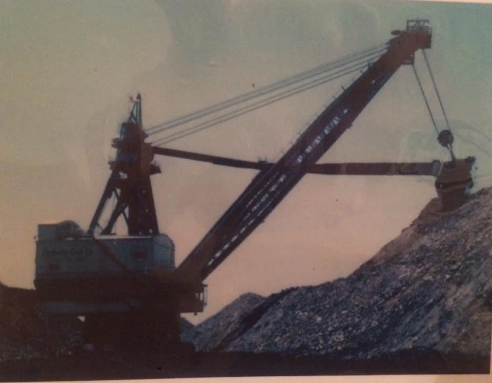
A coworker purchased a picture frame from a secondhand store, and this picture was flipped around so it looked like it was a blank backboard.
This is the Marion 5900 from Lynnville Mine in Warrick County, IN.
[To summarize some comments, it switched from a fixed-pitch bucket, https://pbase.com/lexyky/image/164876482, to a variable-pitch bucket, https://pbase.com/lexyky/image/174152281. I don't know what that means, but the photos are interesting. I noticed that the "before" photo is dated 2016, whereas the "after" photo is dated 2008. So I'm confused.]


Lynnville, IN: Museum of the Coal Industry

(Satellite)

They not only had exhibits concerning the big mining shovels and draglines, they tried to explain the importance of coal to everybody before electricity and natural gas became available.
20150117 0084

Museum Of The Coal Industry posted three photos with the comment:
THE MINING HISTORY OF LYNNVILLE PARK
Many people know that today’s Lynnville Park was donated by Peabody Coal, but they were not the first company to mine this land.
At the turn of the last century, there were several coal mines and coal banks in the area around Lynnville. Several families who owned land started their own mines to provide fuel for cooking and heating their homes.
Lewis Nordhorn owned the land just west of present day Peach Street. He started an underground mine providing coal for his family and friends.
In 1958, Peabody Coal bought a 5761 stripping shovel and set it to work south of Highway 68 and west of Highway 61. From there it worked east and west and then moved north. For a period of time, highway 68 was closed while Peabody mined through, and a runaround road was put in from highway 61, past the Peabody tipple, to the site where Tecumseh Jr.-Sr. High School sits today. Once the 5761 stripped north, Highway 68 was put back in. Peabody put in an underpass to allow coal trucks and other mining equipment to get from the tipple and office to the pit.
The 5761 continued to mine north of Highway 68, and in 1962, it accidentally found the former site of the underground Nordhorn mine, with the result of the machine actually dropping partially into the hole and having to be removed.
As mining operations wrapped up, Peabody focused on creating Lynnville Park lake, planting trees around it and stocking it with fish. In July 1965, the park land was donated to the Town of Lynnville. At the time, it was the largest city park in the state of Indiana.
In the years following, shelter houses and camping sites were developed and lots were leased out for homes and cabins around the lake.
1
Stripmaster 5761 in 1968.

2
A side view of the Stripmaster 5761

3
Picture taken of a family boating on Lynnville Park lake in 1965-66. We’d love to know if anyone can tell us who was in the boat! 

(new window)  I think it was the company house they were building when I visited. And the company store was yet to be built. It is nice to see that the museum has made such good progress.


Thursday, September 10, 2020

Perry C: DuQuoin, IL: Consol/Truax Burning Star #2 Coal Mine

(Satellite)

Museum Of The Coal Industry posted
We are open! Come visit us and check out the newly paved Tecumseh Trail between the Museum and Lynnville Park!
In the photo below, we're highlighting one of the Consol mines in Illinois, Burning Star #2. Here they are mining two veins of coal at the same time. The 1060B bucket wheel excavator removes the overburden and uncovers the top vein of coal, which is then removed and sent to the tipple.
The 5761M shovel then removes the next layer of overburden to uncover the next vein of coal, and the 181M loader places the coal into a haul truck.
This mine produced about 2 million tons of coal per year.

Dennis DeBruler shared
I got to see “The Big Wheel” on it’s side. Me and a buddy were playing hoops in his driveway and his brother pulls up in his Consol truck. He says jump in back you guys gotta see this. Long story short it was quite a sight. We watched from the high wall side for some time until a bunch of limousines came down the haul road. Tom said we gotta go that’s the big wigs from the office.
I am not trying to cause any controversy with my first post, but I worked 18 years for Consol at various surface mines in southern Illinois. B.S. #2 is not mining two seams of coal in this picture. The wheel removes the unconsolidated material (dirt) to expose the consolidated material(rock). The drill then drills the rock overburden to blast prior to removal by the shovel. The drill can be seen on the bench through the framework of the wheel. The shovel exposes the #6 seam of coal (Herrin coal), which is then loaded by the 181 shovel and haul trucks, There is sometimes a #7 or #7A seam of coal, but that is very rare and usually too thin and of poor quality to be mined.

This is a better exposure.
Ron Keller posted
Consol coal burning star mine #2 Du Quoin Illinois . 5761 65 yard bucket . 1060 wheel excavator, 181 coal loader . 150 ton Euclid trucks . Closed 1997.
I was pit boss in that pit midnight shift 25 years. We ran 3 pits. The 5761 1060 pit . 2570 with 135 yard bucket pit and 1350 ransom rapier and English drag line with a 35 yard bucket.
Myron Dudenbostel: Truax Traer, later Consol, had 3 181Ms.... IIRC Norris Mine 181 had the long sticks and a 10 yd bucket, BS#1/ BS#3 181 had the medium length sticks and a 12 yd bucket (spent 3 yr as an oiler and operator), BS#2 had the short sticks and a 14 yd bucket. Remember talking with Lenord West, Consol's head maintenance man, the one at #3 had the best combination of stick length and bucket size.


Directory

Map

The northern spur connected to the UP/MoPac and the southern spur connected to the CN/IC.
RR Aban Map

Later, I noticed that the polygon north of IL-154 was also labeled 864. This tends to confirm that the unlabelled polygons must also be 864.
RR Aban Map
 
Ron Keller posted
1350 ransom rapier from Consol coal Burning Stsr mine #2. In southern illinois .
For a English made machine it was a good one . We got it out of Canada
William Oldani: The Queen, dropped her Point box off in early 80's
Steve Erdmann: William Oldani I was our boss that night when that happened!
Jay Wilson: William Oldani Did it just break out of the end of the boom ??
William Oldani: Jay Wilson pretty much

James Stine commented on Ron's post
After repairs.

James Stine commented on Ron's post
Is this event Your talking about?
Steve Erdmann: James Stine yes but don’t remember exactly when!

James Stine commented on Ron's post

TheSouthern

The Truax Traer Coal Company ran a surface mine in Du Quoin from 1951 to 1970. 


William J. Beck posted four images with the comment: "I want to share a photo of my favorite stripping shovel -- the Marion 5761 with a 65 cu yd bucket. My first real job was at Consolidation Coal Company's Burning Star #2 near Du Quoin, Illinois in the M 5761 pit. My other favorite stripping shovels are the GEM and the Silver Spade which was operated by Consol near Cadiz, Ohio. Included is a summary of shovel specs compiled in "An Analysis of Strip Mining Methods and Equipment Selection" dated May 29, 1973."
1
Marion 5761

2
The GEM

3

4
The Silver Spade

Ron Keller posted two photos with the comment: "51 LDT Euclid bottom dump truck. And Washed coal pile.  Consol Burning Star mine #2."
David Perardi: In 1976, that truck was painted red, white and blue in celebration of America’s bicentennial. Guido Ogolini, a World War 2 veteran, was the driver.
1, cropped

2, cropped

Mike Walker posted two photos with the comment: "My dad took this pic. I believe this is Consol #2 on family property west of Du Quoin. Early 70’s and today."
1

2


Covington, GA: 1989 General Mills Plant

(Satellite)

This plant tripped my 2+2 rule (2 mentions in 2 days.) The first mention was in a comment explaining that this plant and a plant in New Mexico replaced the unionized plant in Chicago, which was torn down in 1995. The second mention is that they are expanding the plant to make more Cinnamon Toast Crunch. "Cinnamon Toast Crunch is one of our most beloved brands as the number two cereal in the United States, and growing....About 400 workers are currently employed at the plant. 40 new jobs were created as a result of the expansion." [PowderBulkSolids via Facebook]

On my 1928 RR Atlas, the railroad is labeled "GA" and goes between Atlanta and Augusta.
Satellite


Monday, September 7, 2020

Toledo, OH: NS/NYC/LS&MS Oakdale Tower at CSX/B&O/CH&D Overpass

(Satellite)


Wayne Koch posted
NYC-InterstateExpress_OakdaleTower,Toledo,Ohio,May1953 NYCHS.
James Tanner The water tower in the background still stands today.
Dennis DeBruler Please provide the street names for a nearby intersection. I can't find Oakdale on my 2005 SPV Map.
Ray Bottles Oakdale was a interlocking Tower on the New York Central NOW CP 286 Two miles East of Toledo Ohio CUT Depot that CP288 !! Take it from someone that's been around over 50 years as a Conductor and prior to that a Railroad Fan 70 years!! You won't find that on a MAP!!!

The discrepancies between the 2005 SPV Map and a current satellite image are interesting. I wonder how much these differences were changes in a little over 10 years and how much these differences were errors in the map. The map shows that B&O used to go straight through and cross the NYC. And that the connection in the northwest (west) quadrant existed. But it shows the B&O was abandoned from that connection all the way to the NS/WLE tracks by the oil refinery. As we can see, the track still exists northeast of the crossing. In fact, the orange connection has been added. The names for the two connectors to the NYC are the names on the SPV Map.
Satellite plus Paint

The transloading yard down by Oakdale Avenue is new. We can still see the overpass bridges for where the B&O route used to go under them.

I assume this is the water tower that James mentioned. Obviously, the water tower has been upgraded. I guess the road in the photo is Fasset Street and we are looking southeastish. The following topo map confirms that there used to be a lot more tracks through here.
1952 Toledo and 1951 Rossford Quadrangles @ 1:24,000

Even though I still can't completely reconcile the photo with the location, the following excerpt from a 1953 employee timetable confirms that the current CP286 used to be Oakdale.
CanadaSouthern, p10