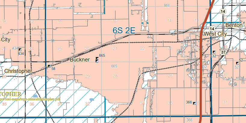
C&NW: (Satellite)
Coal Dock: (Satellite, I'm guessing. The topo map below shows this did have rail service.)
This town has (had?) another concrete relic: the C&NW coaling tower.
 |
| One of 36 photos posted by Ashland Historical Society Museum Here are some photos that Ocky took back in about 2012 of the Soo Line ore dock, including graffiti. Enjoy. Jim. |
 |
| Ashland Historical Society Museum posted Milwaukee, Lake Shore & Western Railroad ore docks in Ashland, Wisconsin. This is probably in the 1880s. As you can see, the boats are outfitted with sails at this time and possibly some had steam power. These docks were located on the eastern end of Ashland, where later the three Chicago & Northwestern ore docks would be located. Enjoy. Jim. David Schauer shared Nice flashback to the early years of ore shipping through Ashland. Robert J Envall: Thanks for sharing, David. I didn’t know that ore was shipped and mined from Wisconsin. (Did they ship pellets)? I grew up in Two Harbors, and we shipped pellets from the Iron Range/Babbit: My Dad worked at Reserve mining in Silver Bay (not sure where they got the mined ore, but they converted it to pellets and shipped onsite.) David Schauer: Robert J Envall No processed ore pellets from Ashland. Last boat loaded in 1965 and by that time rail shipments to Escanaba were proving successful. Iron ore off the Gogebic Range. James Torgeson: David Schauer Last boat was the Str. Bethlehem that loaded for the Bethlehem Lackawanna Plant. |
.jpg) |
| Ashland Historical Society Museum posted November 1919 - Soo Line Railroad ore dock on the left (900 feet long at this point) with the Wisconsin Central Railroad ore dock on the right. The ore boat Harvey D. Goulder is at the Soo Line and the W.C. Richardson and R.L. Agassiz are at the Wisconsin Central. Enjoy. Jim. Kent Rengo shared James Torgeson shared |
 |
| Jeff Cate, Apr 2018 |
 |
| Ashland Historical Society Museum posted 1929 - The newly extended Soo Line Railroad oredock, Ashland, Wisconsin, making it over 1800 feet long. Can anyone tell if any of the boathouses in this photo still exist? Enjoy. Jim. Richard Fiedler shared |
 |
| Ashland Historical Society Museum posted 1917 - Construction of the Soo Line ore dock in Ashland, Wisconsin (the initial 900-foot section). This photo was taken from atop the Wisconsin Central Railroad ore dock, located just east of the Soo Line ore dock at the time. In the background, you can see the stacks of lumber on the docks of the John Schroeder Lumber Mill, which is now the location of Kreher Park. Enjoy. Jim. Rick Starosta: An Amazing achievement for Ashland and the time period. It always amazes me what our forefathers could accomplish with such details especially with the technology available to them |
 |
| Ashland Historical Society Museum posted 1917 - Construction on the initial 900-foot section of the Soo Line ore dock in Ashland, Wisconsin. Off to the left is the very active Wisconsin Central ore dock at this time. Enjoy. Jim. |
 |
| Ashland Historical Society Museum posted 1959 - RAYMOND H. REISS taking on a load of iron ore at the Soo Line ore dock in Ashland, Wisconsin, which was 1,800 feet at this time. The C&NW and the Soo line brought Gogebic Iron Range ore to Ashland to be shipped from this dock. Loaded ore cars are visible on the dock waiting to be emptied into the ore bins. Enjoy. Jim. James McCarthy: So with ore docks this long, could multiple ships load at once back then, on the same side? Tom Mathisen: Yes - two ships could load at the same time on one side. That was the reason for doubling the length of the dock in 1923-1924 adding on to the 1915-1916 section. At least back when the ships were much shorter. There are two great things about this photo: the first is have not seen many dead on photos with chutes down. It shows how the “ore pockets” many times were already refilled before the next ship arrived. This vast storage is the equivalent of today’s huge taconite pellet piles next to the one working Duluth ore dock. The second is it shows two missing chutes. Sometime I think in the 60’s an ore boat damaged two chutes and left them dangerously hanging. They weren’t side by side but rather one in between them was undamaged. Study the photo. The railroad called in Ed Erickson from Bayfield with his repurposed WW2 landing craft, then and still today, a repurposed self propelled working barge, named “The Outer Island”, complete with it’s vintage crawler crane, to use a cutting torch and skilled labor to cut down and haul away said damaged chutes. And where are those chutes still today one might ask? 60 years later they still serve as shore protection opposite from where the Outer Island still ties up at Kenny Dobson’s marina (Blackhawk?) in Bayfield. Kent Rengo shared |
The remnant we see today would have been the closer long dock. There are still remnants of the other one under the water.
 |
| Satellite |
 |
| Jeff Cate, Nov 2012 |
 |
| James Torgeson shared Building the Soo Line ore dock in Ashland, Wisconsin on Lake Superior. Ore from the Gogebic Iron Range was shipped via this dock until 1965. The last ore cargo was loaded on the Str. Bethlehem, bound for Lackawanna. The dock has been demolished to the water level and will soon be a public recreational pier. |
Remnants of one of the C&NW ore docs still exist.
 |
| Satellite |
The tracks going east were the C&NW and the tracks going south were the Soo.
 |
| 1947 Ashland Quadrangle @ 1:62,500 |
 |
| Ashland Historical Society Museum posted 1954 - Chicago and North Western Oredock - Ashland, Wisconsin Moose Mihalak: An old Cliffs boat! James Torgeson shared The C&NW Ashland dock handled iron ore from the Gogebic Iron Range until 1960. |
 |
| Terry Krawczyk comment on a share of a post of seven photos and a video of the 2012 demolition, cropped |
%20Lake%20Superior%20Ports%20&%20Shipping%20_%20I%20picked%20up%20this%20postcard%20recently%20of%20the%20.png) |
| Comments on a post https://mywisconsineyes.com/Culture/ashland-ore-dock.html |
James Torgeson shared
Demolishing the former Soo Line ore dock at Ashland, Wisconsin, which handled ore from the Gogebic Iron Range. The final ore cargo was loaded on the Str. Bethlehem in 1965.
Michael Maitland: Read a few years back that there was a company looking at a rich deposit at the southern end of the range, still viable to mine.
James Torgeson: Michael Maitland Yeah, but I haven’t heard anything about that lately.
A post about ore punchers who worked both here and at other ore docks
James Torgeson shared
Frank Castro: Had a car tip over on the bf trestle because one side of the car was frozen. When the car emptied, the ore frozen on one side caused it to tip over.
33 construction photos and a history via a share "The new Soo Line ore dock would become the first all-concrete ore dock in the world and largest of its kind at the time. " This replaced an ore dock made of wood.
 |
| Marine Historical Society of Detroit posted A MHSD member, James Semon, gifted the organization a collection of ship photos taken from about 1957 into the 1970's by Willis A. McCaleb. Mr. McCaleb was at one point the official corporate photographer for the Nickel Plate Railroad. Here is a random sample taken from the portion of the collection which has already been scanned. The Augustus B. Wolvin unloading coal at the C. Reiss Coal Company Dock No. 2 at Ashland, WI in 1959. Willis McCaleb photo/MHSD. Per the "Ship Masters Association Directory of 1962", the unloading bridge crane at the dock was built by Mead-Morrison, used a 5 ton clam shell bucket (2 ton for cleanup) and had a capacity to unload 3,000 tons in a 10 hour shift. The dock itself had a capacity to store 250,000 tons of coal and had a 20 foot depth of water alongside. The Wolvin had a capacity to haul 10,800 tons of coal in its four holds, which would mean a 36 hour minimum unload time if fully loaded. David Schauer shared A wonderful image from Ashland. If you have an interest in Great Lakes vessel history, I recommend joining the MHSD. |
 |
| 1942 Ashland Quad @ 42,000 |
 |
| 1 of 8 pages of a book posted by Thomas Becher in Soo Line Historical & Technical Society Group |
Ashland Historical Society Museum posted 21 photos with the comment:
The Wisconsin Central Railroad Ore Dock in Ashland, Wisconsin, played an important role in the Great Lakes shipping industry, especially during the late 19th and early 20th centuries, when iron ore mining was booming in northern Wisconsin and Michigan's Upper Peninsula. In the late 1800s, Ashland became a major shipping point due to its proximity to rich iron ore deposits in the Gogebic Range (near Hurley and Ironwood, Michigan).The Wisconsin Central Railroad (later part of the Soo Line) recognized the need for efficient ore transportation from the mines to ships on Lake Superior. To meet this need, they built an ore dock, a huge wooden and steel structure designed to transfer iron ore from rail cars directly onto waiting ships.The dock was constructed to handle the volume of ore efficiently. Ore would be brought in on trains, dumped into hoppers, and then gravity would drop the ore through chutes into the holds of waiting freighters below.It was one of several massive ore docks in Ashland. At one point, Ashland had five ore docks, some of the largest docks on the Great Lakes.The Wisconsin Central Railroad ore dock's construction occurred during the late 1880s, and was continually upgraded and modified as shipping and mining demands grew. This dock contributed to Ashland becoming a thriving port city. In December of 1919, this older dock was demolished after the more modern Soo Line Railroad ore dock had been completed in September of 1917 just west of it.Thousands of tons of iron ore passed through the dock annually. Ore from this dock fueled the steel mills in cities like Cleveland, Detroit, and Chicago during America's industrial expansion. Ashland was so busy that it competed with larger ports like Duluth-Superior for shipping traffic.By the mid-20th century, changes in the steel industry, the depletion of local ore fields, and the shift to taconite (which used different loading methods), reduced the need for these huge ore docks. The last ore shipment out of Ashland occurred in the mid-1960s.Remnants of the structures from the Wisconsin Central Railroad ore dock can still be seen off the shoreline near Ashland’s waterfront.Enjoy. Jim.
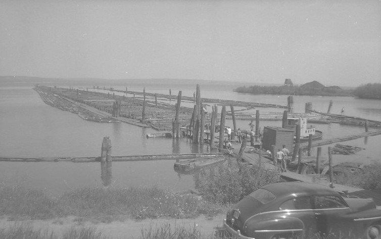
Tom Jerow: The Forest History Association of Wisconsin hosted a webinar by Tom Stanley on the adjacent Consolidated Papers' pulpwood rafting/hoisting operation. Check it out on our YouTube channel: https://www.youtube.com/watch?v=JRh8EHHBamI
Daniel Peters shared
 |
| 1 1907 - Wisconsin Central Railroad ore dock, Ashland, Wisconsin. |
 |
| 2 1924 - Remnants of the Wisconsin Central Railroad ore dock with the chutes of the new Soo Line Railroad ore dock visible on the left. |
 |
| 3 1950s - Remnants of the Wisconsin Central Railroad. The pilings and floating pulp logs were an attractive lure to the Ashland youth as a swimming hole, as two boys can be spotted in this photo standing atop a log. The Soo Line Railroad ore dock can be seen on the left of the photo. |
 |
| 4 The Soo Line ore dock can be seen in the bottom of this photo with the pilings from the Wisconsin Central ore dock right behind it. The C&NW No. 2 and 3 can be seen at the top. The No. 1 was demolished at this point. At one point all five ore docks were in operation in Ashland. Paul Clore: Two coal docks in the middle |
 |
| 5 Aerial view of the Soo Line ore dock with the pilings of the Wisconsin Central just east of it. The Holy Family Catholic Church can be seen in the bottom of the photograph. |
 |
| 6 View of the Wisconsin Central dock at the base of Ellis Avenue (now the location of the Ashland marina) at the bottom of the photo, then the John Schroeder lumber mill (now Kreher Park), and then the Wisconsin Central Railroad ore dock in the background with a train with cars full of ore to be off-loaded onto ore boats. |
 |
| 7 Wisconsin Central Railroad ore dock, Ashland, Wisconsin. |
 |
| 8 Aerial view showing the ghost of the Wisconsin Central ore dock and the Soo Line ore dock just west of it. |
 |
| 9 |
 |
| 10 November 1919 - Soo Line Railroad ore dock on the left (900 feet long at this point) with the Wisconsin Central Railroad ore dock on the right. The ore boat Harvey D. Goulder is at the Soo Line and the W.C. Richardson and R.L. Agassiz are at the Wisconsin Central. |
 |
| 11 |
 |
| 12 |
 |
| 13 |
 |
| 14 1920s - Remains of the Wisconsin Central Railroad ore dock on the right and the Soo Line ore dock on the left. The Soo Line ore dock was 900 feet at this point and you can see the additional 900-foot section being added to the ore dock during this time. |
 |
| 15 Red arrow pointing to the remains of the Wisconsin Central ore dock. |
 |
| 16 |
 |
| 17 Rare photo of a whaleback at the Wisconsin Central Railroad ore dock. |
 |
| 18 |
 |
| 19 |
 |
| 20 |
 |
| 21 Wisconsin Central Railroad ore dock in the background. Paul Clore: What street is the streetcar running on? Ashland Historical Society Museum: E. 2nd Street |
 |
| Josh Schield commented on the above post Also busy back in 50s 60s [The dock on the far right looks likes it unloads freighters.] |
Ashland Historical Society Museum posted 11 photos with the comment: "Photos showing the C&NW No. 2 & No. 3 ore docks and how the trestles crossed the highway in eastern Ashland, Wisconsin."
 |
| 1 |
 |
| 2 |
 |
| 3 |
 |
| 4 |
 |
| 5 |
 |
| 6 |
 |
| 7 |
 |
| 8 |
 |
| 9 |
 |
| 10 |
 |
| 11 |