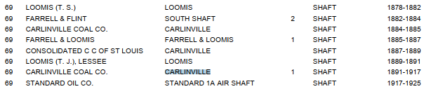
#1 Mine
 |
| Roger Kujawa posted Coal Mining Operation in Carlinville, Illinois 1910s. Paul Meier Looks like it was along the IT. Also looks like an interlocking tower in the left background. |
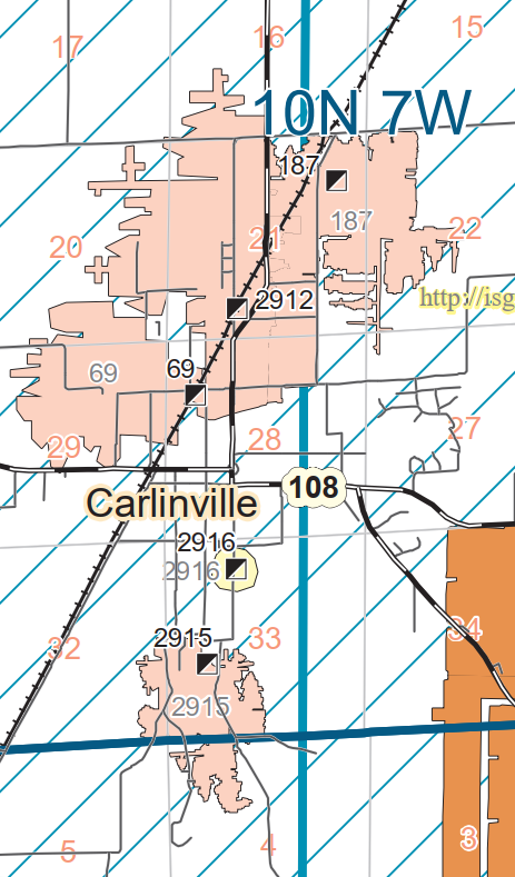 |
| Dennis DeBruler commented on Roger's post The interlocking tower indicates that this was mine 69. |
 |
| Dennis DeBruler commented on Roger's post |
 |
| Dennis DeBruler commented on Roger's post The mine closed in 1917 and then Standard Oil used the shaft to ventilate their mine, which was #187. So it makes sense that the tipple is gone by 1939. But it appears the location of the interlocking tower has changed. I think the above photo is looking East and we see the IC tracks in the foreground. The IT would have been a little further east. Both IC and Chicago & Alton could serve this mine. This old building on a diagonal dates from at least 1939. https://www.google.com/.../data=!3m6!1e1!3m4!1sSdYVmAd... |
South Mine
Jim Yasinski posted two images with the comment: "This was all that was left of the South Mine at Carlinville, Illinois in the mid 1970s."
 |
| 1 |
 |
| 2, rotated |
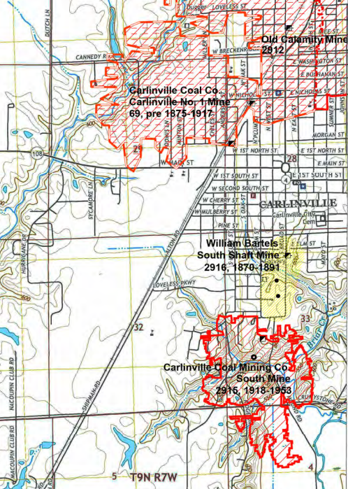 |
| Dennis DeBruler commented on Jim's post https://wikiimage.isgs.illinois.edu/ilmines/webfiles/topo-mines/carlinville-west.pdf |
 |
| Dennis DeBruler commented on Jim's post It was served by an interurban railroad. 1931 Carlineville Quad @ 62,500 |
No comments:
Post a Comment