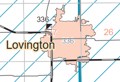
Wabash Depot: (Satellite, between Railroad St. & the tracks and halfway between State and Church Streets.)
Pennsy Depot: (Satellite, south of the tracks and west of Broadway Street.)
 |
| Roger Kujawa posted Coal Mine, Lovington, Illinois. 1910s Postcard. This was on the PRR Line (Vandalia) Rob Manley My Grandfather was a coal miner there. He was later the town grocer, butcher, restaurant owner. My first train ride was from Chicago Ridge to Decatur on the Wabash to visit him. |
 |
| Andy Zukowski posted Coal Mine in Lovington, Illinois. 1908 |
 |
| Jim Yasinski posted Lovington, Illinois Coal Mine |
 |
| Andy Zukowski posted, cropped Coal Mine Shaft in Lovington, Illinois. C1910 |
 |
| https://wikiimage.isgs.illinois.edu/ilmines/webfiles/topo-mines/lovington.pdf |
Unlike some towns that avoided building over their mine, this town was on top of their mine.
 |
| 1940 Aerial Photo from ILHAP |
 |
| At photo resolution The tipple is in the upper-left corner and it appears that a grain elevator was south of the Pennsy and east of Broadway Street. Grain Street confirms the grain elevator theory. Is the long white building northwest of the tipple the one still standing south of Williams Street? |
Pennsy was east/west and Wabash was north/south.
 |
| Aban RR Map |
Wabash Depot
Another Illinois town that has lost both of its railroads.
 |
| Andy Zukowski posted Wabash Depot in Lovington, Illinois. C1910 Richard Fiedler shared Richard Fiedler shared Richard Fiedler shared |
 |
| Andy Zukowski posted The Wabash Railroad Depot in Lovington, Illinois. 1960 Richard Fiedler shared Richard Fiedler shared Richard Fiedler shared Andy Zukowski posted a different exposure with the same comment |
 |
| Larry Candilas commented on Andy's second post MP 167.0 8th District; crossed PRR Peoria line in town. A few years earlier - 1910 |
 |
| Andy Zukowski posted The Wabash Railroad Depot in Lovington, Illinois, circa 1910. Larry Candilas: Station was on west side of tracks so I'm guessing this is a northbound. Dennis DeBruler: I like photos of depots that include grain elevators. Richard Fiedler shared |
History of the Heartland posted two photos with the comment:
The Wabash depot at Lovington in 1910 and 50 years later in 1960. The branch led from Bement to Effingham and Altamont. By 1960 it terminated at Sullivan, the stop after Lovington. The last activity on the line was on February 12, 1974, 52 years ago today, when it was embargoed by the Norfolk & Western.Photos:1910 - Collection of Larry Candilas1960 - Wabash RR, Collection of Andy Zukowski
Richard Fiedler: The tracks from Streator to Effingham and Altamont were constructed by the Chicago and Paducah RR but absorbed into the Wabash (WStL&P) and became the a key part of the Decatur to Chicago Route. The north end of the C&P from Risk to Streator became a branch and the south end of the C&P from Bement to Effingham and Altamont became a branch as well but with a very poor traffic base.
JD Cooke: A somewhat unique NON interlocked crossing depot with STOP boards and round the clock operators. NS M-F, day shift and PRR all other shifts including day shift Sat and Sunday. 1967 employee timetable.
Michael Moran: South from Sullivan to Windsor, Strasburg, and Stewardson, before splitting at Shumway to go either to Effingham or Altamont. Tracks were mostly gone or covered up in Stewardson before 1955. The freight depot was used for storage by local Boy Scout troop for a while in late ‘50’s. The cross-cross section of tracks where it crossed the Nickel Plate was still in weeds beside the Nickel Plate tracks in lates ‘50’s. Part of Trestle across Little Wabash NW of Effingham were still visible in late ‘50’s. Born in 1950, I do not remember trains on it, only stories from older brothers and father. A story my 6th grade teacher told; a man had to retrieve a horse, carried his saddle onto the train… conductor commented, “ I know it is a rough riding train, but is a saddle necessary?.
Richard Fiedler shared
 |
| 1 |
 |
| 2 |
A topo map marks the location of the two depots.
 |
| 1940/40 Sullivan Quad @ 62,500 |
Lovington was on the branch that went South from Bement to Effingham and Altamont.
 |
| Bill Molony posted via Dennis DeBruler |
There should have been a grain elevator out-of-frame to the left in the depot photo.
 |
| 1940 Aerial Photo from ILHAP |
The grain elevator along the Pennsy survived.
 |
| Satellite |
And fertilizer application is also big business.
 |
| Satellite |
No comments:
Post a Comment