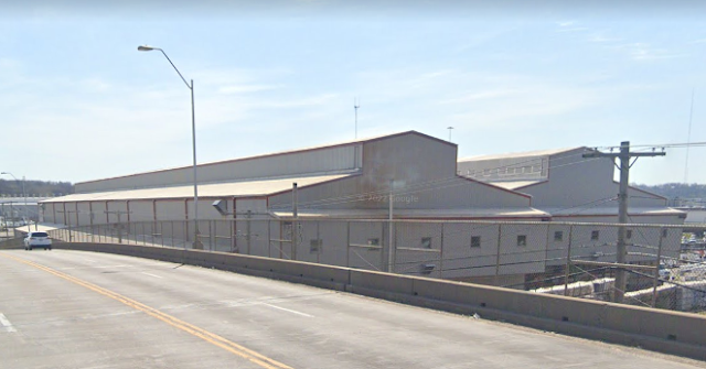
Middle: (Satellite, the mill expanded to include this lobe.)
South: (Satellite, and this one further south.)
"Information on the Sheffield Steel Company and its Armco division in the Sheffield industrial district of Northeast Kansas City along the Blue River, established in 1888 as the Kansas City Bolt and Nut Company and closed in February 2001." [KChistory] That web page also has links to five photos, but the copyright does not allow copies for educational purposes. So I'll describe the photos and make it easy to access them:
- continuous wire drawing machines
- 1955 aerial photo looking South, includes a roundhouse and coaling tower in the lower-right corner.
- 1955 aerial photo looking Southeast
- 1955 aerial photo looking East
- 1955 aerial photo looking Northwest, there are four grain elevators in the background and the "Montogmery Wards buildng."
Greg Whitehead posted two photos with the comment: "Kansas city armco works does anyone know what building is what."
 |
| 1 [The 1955 lobe is on the left.] |
 |
| 2 [Again, the 1955 lobe is on the left. This is when I realized that the lobe on the east side of the river was also part of the plant.] |
I included the Montgomery Wards Building in the upper-left corner. I'm surprised the catographer did not include the roundhouse that was in the northwest quadrant of the junction of MoPac and KC Terminal. Most topo maps include roundhouses rather accurately. My current guess from the KChistory photo is that it was a KC Terminal roundhouse.
 |
| 1957 Kansas City and independence Quads @ 24,000 |
It looks like at least of the buildings got repurposed.
 |
| Street View |
The building on the right was the 12" mill and the one by the road was 12" shipping. [jchs via pinterest]
 |
| Street View |
.jpg) |
| Suzie Scott uploaded to pinterest Sheffield Steel 1955 [Looking Northeast] |
 |
| Photo by Larry Nicholson via My Farher's Archive |
It took a lot of wire to fence the grazing lands of the Praries.
 |
| RustyWindmill, also WorthPoint and eBay |
 |
| WorthPoint OLD NUT AND BOLT PAPERWEIGHT ADVERTISING KANSAS CITY ARMCO STEEL CORP. 1963 |
The resolution of this photo is not good enough to see the roundhouse.
 |
| city-data, at source resolution |
I had noticed that the Blue River had become a ribbon of concrete. That was part of a $286m flood-control project. [dvids] They have been widening the channel since at least 1992. [trainspo]
 |
| dvids An aerial view of the lower six miles of the completed channel. The project provides a hydraulically efficient channel of 35,000 cubic feet per second capacity to move water through this industrialized corridor and significantly reduces the threat of flooding to the entire valley. |
Fortunately, they did not gut nature in all of the 12.5 mile long project. (Let's face it, there was no nature left in the industrial area where they made a concrete ribbon.)
 |
| dvids-2 A typical view of the channel looking upstream from one of the rock grade control structures. Natural channel conditions and adjoining habitat areas were preserved with minimal disruption. |
No comments:
Post a Comment