Friday, October 7, 2022

1913,2010 18mw Healey Falls Hydro Plant and 2-Flight Locks #16+#17

(Satellite)

Locks #16 and #17 are part of the Trent-Severn Waterway.

Ontario Power Generation posted two photos with the comment: "On the Trent River, near Campbellford, you can find our 109-year-old Healey Falls Generating Station. The station is currently [Oct 2022] undergoing a 10-month-long overhaul on two of its generating units. This important work will ensure the station can continue to generate reliable and carbon-free electricity for many more decades to come. Learn more: https://bit.ly/3e6cc2w"
Dave Trumble shared
1

2

"Placed into service in 1913, Healey Falls GS originally had three units. In 2010, OPG completed a project to increase the plant’s capacity by adding a new 6.4-megawatt (MW) unit, bringing the station’s total combined capacity to 18 MW." It is units G2 and G3, which share the original middle penstock, that are being overhauled. [opg]

HydroReview
It celebrated its 100th anniversary in 2013.

"OPG owns and operates 65 hydroelectric stations across Ontario. More than half of these stations have provided clean renewable energy to Ontario for more than 80 years." [NewsWire,]

Ontario Power Generation Flickr, License: Creative Commons Attribution (CC BY)

A satellite image showed that the canal between Locks #16+#17 and Lock #15 was dry.
Satellite

A photo shows that at least the lower lock (#16) was rebuilt.
Filipe Costa, May 2019

They have been working on it for at least a couple of years. 
james poisson, Dec 2017

Filipe Costa, Dec 2018

Here is an "after" photo. I found a photo with a boat in the lock in Aug 2021.
Justin Shaw, May 2022

Skip about the first 1.5 minutes in this video to get to info on this facility. This view reminds me that it took a while at the interesting turn of the century to develop the thrust bearing that is needed for units to use a vertical shaft. They horizontal shaft units are 4mw each. As expected, the 6mw unit that was installed in 2010 has a vertical shaft.
8:00 video @ 3:42

When I first saw the spillway on the side of the powerhouse, I had assumed it was to add oxygen to the downstream water. But when I saw this image, I thought that the flume is a way to automatically remove the debris from the trash screens. But according to the video around 3:11, it is an ice sluice that spills water well after the winter months to support fish spawning. The video shows that the plant has mechanical screen cleaners.
Satellite

Before they rebuilt #16, they rebuilt the west wall of #17.
ptbocanada
"Since October 2016, Parks Canada has been working on repairs to the west wall at Healey Falls Lock 17 on the Trent-Severn Waterway National Historic Site. The work has been progressing well and contractors are on track to complete repairs prior to navigation season in May 2017."


27:14 mixed-speed video going downbound in Aug 2014 The old concrete walls do look worse for the wear. At 26:00, the boat enters Lock #15.

Thursday, October 6, 2022

Fort Wayne, IN: (NS+CF&E)/Pennsy Piqua Yard

NS part: (Satellite, this used to have the Triple Crown Yard [fwarailfan])
CF&E Part: (Satellite)

Pennsy had a locomotive servicing facility (roundhouse) with a coaling tower west of this yard.

Jim Pearson Photography posted
Chicago, Ft. Wayne and Eastern Railroad locomotives 5597 (ex CP Rail) and 2132 sit in their yard at Ft. Wayne, Indiana as they wait to depart the yard on September 22nd, 2022.
According to Wikipedia: The Chicago, Fort Wayne and Eastern Railroad (reporting mark CFE) is a short line railroad offering service from Tolleston, Indiana to Crestline, Ohio, United States over the former Fort Wayne Line of the Pennsylvania Railroad. It began operations in 2004 as a division of the Central Railroad of Indianapolis, under the overall corporate ownership of RailAmerica. CFE operates 273 miles of rail leased from CSX.
On July 23, 2012, Genesee & Wyoming Inc. announced that it intended to purchase RailAmerica in a deal valued at $1.39 billion.  Approval of the purchase was granted by the U.S. Surface Transportation Board on December 19, 2012, and ownership of the Chicago, Fort Wayne and Eastern was transferred to the G&W.
Tech Info: DJI Mavic Air 2S Drone, RAW, 22mm, f/2.8, 1/3000, ISO 100.
https://fineartamerica.com/.../chicago-ft-wayne-and...

Dennis DeBruler commented on Jim's post
Thanks to the tower on the former International Harvester building in the background, this facility was easy to locate.
https://www.google.com/.../data=!3m1!1e3!4m5!3m4...

Street View, Jun 2019
"Piqua Yard (locally pronounced Pik-Way) is hardly the place it used to be.  After Conrail was formed in 1976 the yard took on less importance and many of the tracks were pulled up.  Today just a few tracks are left and are used fairly often.  There are no locomotive servicing facilites at Piqua Yard and refueling is done using trucks.  This is the RailAmerica Chicago, Fort Wayne and Eastern Railroad office and crew base (former Conrail) in Fort Wayne located next to the Wayne Trace/Pontiac St. viaduct.  This building used to be the hump tower for Piqua Yard." [fwarailfan]

I could not find the hump yard tower in 1951.
EarthExplorer: Mar 27, 1951 @ 28,400, AR1PJ0000010069

According to the above street view, the tower does look relatively new, so I found a 1979 aerial photo. The backshops have been cut back quite a bit. The hump yard is not very wide, but I believe it was on the west side of the Pontiac+Wayne Trace underpass. I saw a railfan photo that reinforced that the hump yard was on the west side because it indicated the hump lead was the north track of the east side.
EarthExplorer: Nov 1, 1979 @ 80,000, AR1VERP00010112

CSX did not want the Pittsburgh, Fort Wayne and Chicago Railway route that it was given when Conrail was split up. So it now leases that Pennsy route to Chicago, Fort Wayne & Eastern. And it leases the east side of Piqua Yard to CFW&E. Norfolk Southern leases the west side. NS had used the southern five tracks for a Triple Crown Yard.

January 18, 2008
Wow, so much for a webmaster, huh? As you can see I haven't updated this homepage in well over a year now, since August 2006. Well I can say there's been many changes in the railroad world around Ft Wayne since then. Probably the most notable thing has been NS adding a second lead track to the Triple Crown track adjacent to the CF&E shortline yard. This has enabled Triple Crown & NS to get trains off of the mainline in the event that Triple Crown isn't quite ready for a train, which frequently happens at night when the yard is the busiest. A diagram of the new lead and how NS accesses the yard can be viewed here. A look at the west end of the yard at Mike can be found here.

First "here" link above

Second "here" link above

Was Piqua tower somewhere here?
Steve Redinbo commented on Ken Kieley Jr.'s post

Viral Media posted two images with the comment:
Former Roadrailer Hub
Triple Crown's main Roadrailer yard was in Fort Wayne at the west end of Piqua Yard.  In this  aerial photo, the trailer can be seen staged to be assembled. The “bogie” railroad wheelsets can be seen next to the yard awaiting to be used to adapt the truck trailers from road to rail.
Triple Crown Services, moved its headquarters out of Fort Wayne in July 31, 2020. The last information I had was a  Triple Crown Roadrailer runs from Detroit to Voltz, Missouri and back 4 days a week. Previously Triple Crown trains ran through Fort Wayne, IN, which was the headquarters and central yard for these  operations. This allowed for hub-and-spoke system seen in the diagram.
A RoadRailer is a semi-trailer that can be hauled on roads by a tractor unit and then by way of a fifth wheel coupling, operate in a unit train on railway lines. Triple Crown trailers ride on rail bogies rather than being lifted up and placed on rail cars. Triple Crown RoadRailers are backed onto the track and placed into position to couple to the rail bogie assemblies. The trailers are connected together and provide a slack-free ride on the rail. Each Triple Crown dedicated train can move up to 150 units from terminal to terminal at a time.
Piqua Yard is a shadow from what it was back in the Pennsylvania, Penn Central, and even early Conrail days.  In it’s prime, it was had a major train classification yard  and locomotive repair facility.
1

2


Wednesday, October 5, 2022

Sun Tan Valley, AZ: Copper Basin Water Reclamation Plant (WRP) and Lagoons

(Satellite, the triangle of dirt north of the UP tracks)

The Walsh Group posted four photos with the comment: "Placing the Miraculous Medal in our first concrete pour for the new Copper Basin Water Reclamation Facility in Sun Tan Valley, Arizona. Copper Basin will replace an existing and outdated lagoon-style plant that was constructed more than 20 years ago. The new plant will allow EPCOR to return more than one billion gallons of safe, clean water annually to the natural water cycle through aquifer recharge."
[It is interesting that they use both a crane with a bucket and a pump truck. ]
1

2

3

4

There were a couple of phrases in that post's comment that caught my eye and motivated me to dig deeper:
  • "lagoon-style plant," sounds like an open cesspool
  • "aquifer recharge," do they pump the water into the ground?
I'm used to Waste Reclamation Plants (WRPs) that use concrete rectangular and circular tanks for multiple stages of solid settlement and digestion. These are "activated sludge" designs. (The "activation" is a special bacteria that eats the organic waste material.) For example, the Stickney WRP uses this design. A quick check of a satellite image shows that my local town, Downers Grove, IL, also uses this technique. Note that these Midwest plants are located close to a stream or river into which they can dump the treated water. 
Satellite

After some research, I determined that lagoons are, in fact, open cesspools. But they can be effective in areas that are hot, land is cheap and the population is low. Depending on the design of the lagoons, water is retained for treatment for days to months. [deu]
epa
[Note that my concerns about algae control on the lagoons are well founded. I believe the green in the lower-right corners of some of those ponds is algae growth.]

A diagram of the new facility taught me about "aquifer recharge." I presume that all of those recharge basins get rid of the water by letting it soak into the ground. (Actually, I wonder how much of the water evaporates rather than soaks in.) Looking at a satellite map, there are some creeks in the area, but they are all dry. In fact the Salt River would be dry in Tempe, AZ, if it did not have a retention dam.
azbex

(That diagram is also what allowed me to determine where the facility is being built. Although I was confused for a while because Sierra Vista Drive has yet to appear on the satellite map.)

I kept coming across the same press release that says: "The new state-of-the-art facility’s treatment process will be fully enclosed and designed to integrate seamlessly into the community. Equipped with industry-leading advanced treatment technologies that meet the Arizona Department of Environmental Quality’s Best Available Demonstrated Control Technology (BADCT) requirements, Copper Basin will ensure delivery of safe, clean, and reliable wastewater service." [e.g. GlobeNewsWire]

But the only information I found about the "state-of-the-art treatment process" is that it uses "biological processes." ("EPCOR has vast experience building and maintaining safe, enclosed water reclamation environments that integrate unobtrusively into their communities. In addition to being fully enclosed, our facilities use biological processes rather than rely on chemicals to treat wastewater. Our Verrado and Anthem (north Phoenix) facilities are examples of this approach" [epcor]) Because a building in the diagram is labeled "Bioreactor," I presume that treatment process is basically a big, above ground, septic tank. (I briefly looked on a satellite map around Verrado and Anthem to find what existing facilities look like, but I could not find anything.)

I finally found that the lagoon facility was "at Magic Ranch." [PinalCentral] That was the clue I needed to find it. One of the reasons to replace this facility is that people complain about the odors. I can easily believe that most of those lagoons stink.
Satellite

2 of 3 photos posted by The Walsh Group, Jan 2023.
a

b


Tuesday, October 4, 2022

Estes Park, CO: 1909 Historic Fall River Hydroplant

(Satellite)
Freelan Oscar (F. O.) Stanley made a career putting water to work. Famous for co-inventing the steam-powered Stanley Steamer auto in 1897, he employed water yet again in 1909 to build a hydroelectric powerplant on the Fall River in Estes Park, Colorado. In 1903, Stanley had moved to little Estes Park, 65 miles northwest of Denver, to combat his tuberculosis. The dry mountain air and plentiful sunshine aided his recovery. In 1909, realizing the town’s need for tourist accommodations that matched its majestic scenery, he built the luxurious Stanley Hotel (later made famous as the inspiration of Stephen King’s 1977 thriller, The Shining). Desiring a world-class resort, Stanley built his powerplant to equip the country’s first “all-electric” hotel with wired heating, cooking, and lighting. The Town of Estes Park soon requested electricity for its street lights, and residents ordered the modern service for their homes.
[nps]

Wayne Wilson (Time_2_Explore), Aug 2022

The plant produced power until it was severely damaged in 1982 by the Lawn Lake Flood. Since 2002, it is an interpretive site and it schedules free tours. [EstesParkNews]

This facility is now part of the Estes Park Museum.

"Built three miles northwest of Estes Park, the one-story, concrete-floored 28 X 26-foot frame building housed a turbine and a 200-kilowatt generator.  The turbine was driven by water siphoned from nearby Cascade Lake via a twenty-inch steel intake pipe." [HistoryColorado]

Obviously, the diversion dam that created Cascade Lake has been breached since the water is no longer needed by the power plant.
Satellite

ArrivalGuides

ReporterHerald
The plant started in 1908 with this Hug water wheel driving a 200kw Western Electric generator.
[I worked for Bell Labs, and I heard that Western Electric made things other than phone equipment. This is the first time I have seen some of its electric power equipment.]

ReporterHerald
One of the several expansions of the plant was this "900 horsepower Worthington-Francis turbine connected to a 680-kilowatt General Electric generator" that was added in 1921.

Another view of the original unit.
Estes Park Museum posted
 
Wayne Wilson (Time_2_Explore), Aug 2022

OldTacomaMarine
The original 50hp diesel engine unit is on display.
It is a Model Y-V with a bore of 14" and a stroke of 17" that runs at 257rpm.
"The Fall River Hydroplant installed a second stationary diesel engine in 1935, a six-cylinder Fairbanks-Morse. This engine was removed sometime in the mid-1940s and its fate is unknown."
 
Katherine "Kat" Knight, Apr 2022

A history of the power plant starts at 1:56.


Monday, October 3, 2022

Minneapolis, MN: BNSF/GN Minneapolis Junction and Bunge Grain Elevator

(Satellite)

67 photos associated with this junction and GN Union Yard.
 
Henry Overzet posted
Perhaps this may come across the right person. This fell out of a calendar I was given today and my curiosity has me needing to know where this is/was. I can't make out any logos or text on the locomotive or the cars. Any help identifying would be greatly appreciated.
Daniel C Carroll Jr. shared
 
Jeff Braun commented on Henry's post
Here's an aerial view of the site in Henry's photo today. The footprint of the roundhouse is visible, but it's gone as is the yard except for a few tracks. The only building remaining is the 1960s era diesel shop used by Friends of 261 (not yet built in Henry's photo). Today this station is Harrison Street on the BNSF, but in the GN era it was Minneapolis Junction and a busy yard and primary facility for servicing GN freight power. It's the junction of the mainlines from Wilmar to the west, St Cloud to the north (timetable west) and St Paul to the east. The photographer in Henry's photo is standing on probably the coal tower which would have been to the upper left in the aerial view. The roundhouse was down to about six stalls by the 1990s and leased to Chicago and North Western when it was completely destroyed by fire. The turntable was moved to the Minnesota Transportation Museum's Jackson Street Roundhouse facility in St Paul in the early 2000s and restored to operation where it's used almost daily. Jackson Street Roundhouse is where GN serviced their passenger power until the roundhouse was closed in the early 1960s and passenger power servicing was moved to the St Paul Union Depot (SPUD) roundhouse.
Jeff commented earlier:
I am going to say this looks A LOT like it’s Minneapolis Junction on the Great Northern Railway and that’s a Great Northern C-3 class 0-8-0 on the turntable. We’re looking timetable east here. GN would have had coal and oil facilities here. The roundhouse is in the middle of a wye here. Behind the photographer is timetable west and leads to joint track with the Northern Pacific past Northtown Yard and the other leg of the wye out of view to the right is also timetable west as it leads to the Wayzata sub and Willmar, passing the GN Minneapolis depot on its way about a mile from here. The east leg of the wye goes to Union Yard and the mainline to St Paul.

Sam Carlson posted
At Minneapolis Jct during August 1973.
Tom Lyman: Mpls. Jct. Power is on Mainline #4 east of the Roundhouse. The S on the switchstand was for the spring switch coming out of the Roundhouse. The 2 shiny tracks are the East Leg of the Wye on the Willmar/Wayzata Sub. The tall building in the background was the Bunge(sp) elevator near CNW East Mpls. Yard.

Dennis DeBruler commented on Sam's post
Remnants of the roundhouse foundation and of the turntable still exist.
https://www.google.com/maps/@44.9945593,-93.2458958,549m/data=!3m1!1e3

Dennis DeBruler commented on Sam's post
This was the resource that let me find the location.
https://digital.library.cornell.edu/catalog/ss:20864960

The roundhouse used to be 180 degrees.
1951 and 1952 Quadrangles

Only the turntable was still standing in 1995.

Actually, part of the roundhouse was still standing in 2002.
Dennis DeBruler commented on Sam's post
Part of the roundhouse was still standing in Dec 2002. Global Earth

Dennis DeBruler commented on Tom's comment
Was (is?) this the Bunge elevator?
https://www.google.com/maps/@44.998593,-93.2494721,235a,35y,39.36t/data=!3m1!1e3
I still haven't figured out where the "CNW East Mpls. Yard" was.

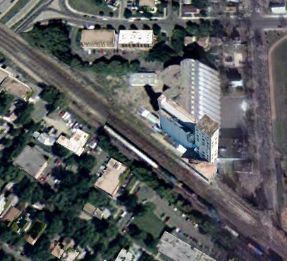
Update: To answer my question: No. The headhouse of the Bunge elevator now appears to be part of a housing project.
https://www.google.com/.../data=!3m1!1e3!4m5!3m4...
Global Earth, Nov 2004

Cornell via search
Bunge Corp. Grain Elevator

EarthExplorer: Nov 28, 1966 @ 24,000, AR1VBOX00010246

Jerry Johnson posted
Great Northern Minneapolis Junction Turntable  Minneapolis MN
Jordan Palmer: Also for a time in the 1980s Chicago Northwestern leased Minneapolis Junction roundhouse from BN as a service hub after tearing down the Minneapolis & St Louis shops that were on the west side of the Twin Cities.
The Minneapolis Junction turntable survives and was donated to Minnesota Transportation Museum and relocated to their location at Great Northern’s Jackson Street Roundhouse in St Paul.
Dean Sauvola: Burned down in 1993, after the C&NW had vacated it. https://www.flickr.com/photos/view2share/8453992028

Evan Smith commented on Jerry's post
1938 aerial. Also of interest in it is the line that curves and ran east. You can find a small trace of it just to the east of the yard in current photos.
Jeff Braun: Evan Smith the line curving off to the east is an NP line, if you look close at the photo, you’ll see the diamond where the NP crosses the GN and continues into that manufacturing complex to the left.