Yard: (Satellite, some land is still undeveloped)
 |
| Michael Dye posted A 1915 fire insurance map of the area around the original site of the NYC/NKP depot in Lafayette, IN (Now sited at 200 North 2nd Street, and repurposed for Amtrak and Bus service). The NKP label caught me by surprise. I now understand that the LEW shared the NYC route from the southeast side of Lafayette to Templeton, IN. https://www.google.com/maps/d/viewer... |
 |
| Dennis DeBruiler commented on Michael's post I'm glad to learn that they moved the depot rather than build another Amshack. https://www.google.com/.../data=!3m6!1e1!3m4... |
The part above the second and third locomotive looks like the above building.
 |
| George M Stupar posted NYC train 415 is seen arriving at Lafayette IN with F3 units 3502, 3601, and 3503 leading the way, on September 22nd 1953. Photographer was W. D. Edson. Mike Stockdale: Only F3's NYC had with steam generators. |
 |
| Michael Dye posted An 1896 fire insurance map of Lafayette, IN, showing the original layout of the NYC passenger and freight facilities, prior to the building of the depot shown in the 1915 map. |
Michael Dye posted two images with the comment: "Two pics from a 1915 fire insurance map of Lafayette, IN, showing the NYC yard trackage, which was located South of the depot and North of Lafayette Junction."
 |
| 1 |
 |
| 2 |
 |
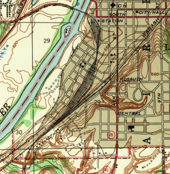
| Dennis DeBruler commented on Michael's post I'm disappointed that the topo map doesn't show the location of the roundhouse. 1942 Lafayette Quadrangle @ 1:24,000 I see the Social Security Admin building has reused the depot land. https://www.google.com/.../data=!3m1!1e3!4m5!3m4... |
No comments:
Post a Comment