Jim Yasinski posted four photos with the comment: "Gillespie, Illinois Coal Mines."
Justin West: How late in the 20th C did the mines last around Gillespie?
 |
| 1 |
 |
| 2 |
 |
| 3 |
 |
| 4 |
 |
| Dennis DeBruler replied to Justin's question 1954, https://wikiimage.isgs.illinois.edu/ilmines/webfiles/topo-mines/gillespie-south.pdf Justin West: Dennis DeBruler TY...do you happen to know if the coal supply were exhausted or if cheaper or less sulphurous supplies put much of central and south central IL mines on ice? Mid-1950s saw a lot of residential use of coal decline in favor of natural gas and demand for railroad use was quickly disappearing with the switch to diesel engines, so they probably helped accelerate the closures of many mines at that time, much like the EPA has effected on mines today as they have pressed for closures of coal-fired powerplants.😕 |
 |
| Dennis DeBruler commented on Justin's comment I think your theory about natural gas and diesel engines causing the 1950s closures make sense. High sulfur didn't close Illinois mines until the 1970s when the Clean Air Act was passed and the EPA took aim at sulfuric acid pollution. Another issue in the 1950s may have been seam thickness. Note that the Shay mine north of Gillespie made it into the 21st Century. |
 |
| Dennis DeBruler commented on Jim's post Research is a lot easier when the cartographer labels the mines. 1912 Gillespie Quad @ 62,500 |
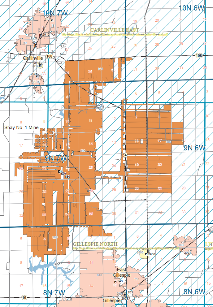 |
| Dennis DeBruler commented on Jim's post I was surprised when a couple of maps labeled the C&NW/LM route as NS. So I further investigated that fact. NS now owns the LM route from their former-Wabash route north to a spur to the Monterey/Shay mine, https://www.google.com/maps/@39.1895506,-89.7988918,1089m/data=!3m1!1e3?entry=ttu UP and NS own the spur and UP owns the LM route north of the wye. |
No comments:
Post a Comment