Virden North: (
Satellite) Closed 1960
Virden South: (
Satellite), southwest quadrant of Holden and the tracks) Closed 1910
Royal: (
Satellite, the wastewater pond is growing a good crop of algae) Closed 1924
See
C&NW Depot for more information about the C&NW and CB&Q railroads in the area.
Jim Yasinski
posted two photos with the comment: "North Mine Virden, Illinois Both cards say North Mine Virden, Illinois, but they look quite different to me."
 |
| 1 |
 |
| 2 |
 |
Andy Zukowski commented on Jim's post
Postcard view of West Mine at Virden Illinois |
 |
| Directory |
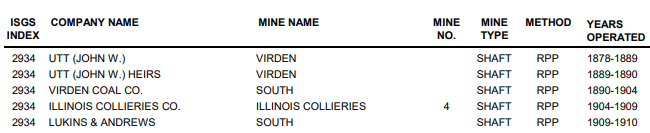
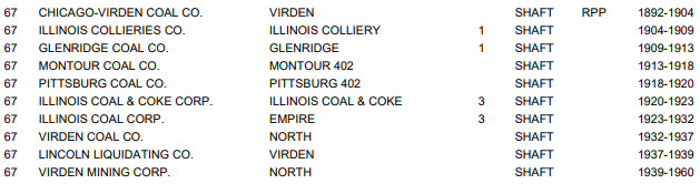
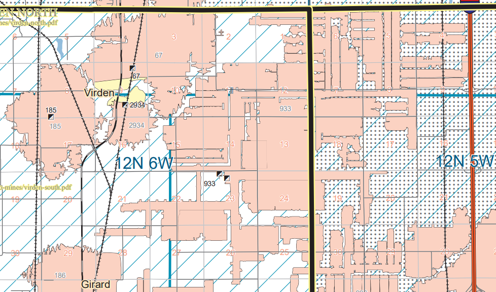
In addition to mine 67, I included mines 185, 2934 and 933 because they are also of interest.
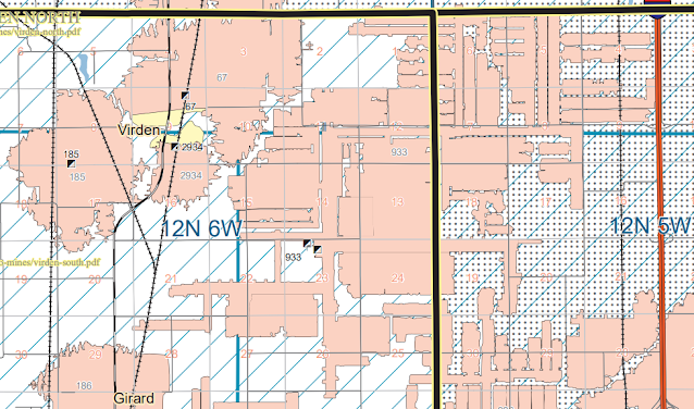 |
| Map |
 |
| Directory |
 |
| Directory |
 |
| Directory |
The following allowed me to determine the satellite location of Virden North.
This map was used to locate the Royal and Virden South mines. When I noticed the BN spur going due east, I found the site for the Crown 2 Mine.
These topo maps show that CB&Q had a spur that went over to Virden and down to the Royal Mine. C&NW shared access to the Royal Mine. CB&Q also had a spur that went North to join a spur from C&NW that went east along the county line to a mine along the GM&O/C&A just south of Thayer.
 |
| 1924 Waverly and 1923 Carlinville Quads @ 62,500 |
About the only thing left for the Royal Mine in 1939 was the tailings pile. But we can see buildings for the Virden North Mine.
This is a closeup of the Virden North mine.
 |
| Digitally Zoomed |


No comments:
Post a Comment