#1: (
Satellite)
Roger Kujawa
posted two images with the comment: "1940s Crown Central Illinois Freeman Coal Mining Bantam Stoker Freeburn Chicago matchbook cover."
 |
| 2 |
 |
| 1 |
 |
Dennis DeBruler commented on Roger's post
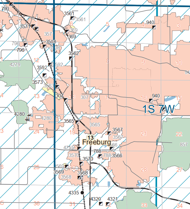
I found a Crown Mine with index 369 near Freeburg in Section 6 with the appropriate dates of 1930-1951, but it strikes me as too small to do this much advertising. |
 |
Dennis DeBruler commented on Roger's post
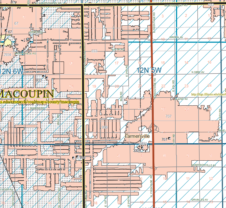
Then I found a Crown #1 owned by Freeman with index 707 by Farmersville. It is certainly big enough to do advertisements, but it has the dates of 1951-71. I include indexes 933 (1976-2007) and 996 (1981-2014) on the map because they were Freeman's Crown #2 and #3, respectively. |
 |
Dennis DeBruler commented on Roger's post
1979 Farmersville Quadrangle @ 1:24,000 |
I include the topo for Crown #2 even though it still exists in a satellite image because I was surprised that it was served by a CB&Q route instead of GM&O or IC. Crown #3 doesn't show up on this 1979 map because it won't be started for another couple of years.
 |
| 1979 Farmersville Quad @ 1:24,000 |
A contemporary map shows that the CB&Q spur was off of their route that goes south to the
Ohio River bridge, of which they are a part owner. I include the two loops of track in the upper-left corner because they are interesting grain elevators. Crown #3 was served by CN/IC.
 |
| USGS |
Jim Yasinski
posted four photos with the comment: "Crown No. 3 at Farmersville, Illinois. Closed December 20, 2013."
 |
| 1 |
 |
| 2 |
 |
| 3 |
 |
| 4 |
I include some satellite images in case they ever clean up the mine sites.
I do hope that this earthen dam holds or that the wastewater is properly disposed of. At least it doesn't look as putrid green as the pond on the northeast side of the property.


No comments:
Post a Comment