Roger Kujawa posted two photos with the comment: "2 Ladd Illinois used real photo postcards 1908-14 Coal Shaft 3rd Vein Coal Co"
 |
| 1 Andy Zukowski posted a darker exposure Illinois 3rd vein Coal Co. Ladd, Illinois 1906 |
 |
| 2 Andy Zukowski posted 3rd Vein Coal Shaft, Ladd,Illinois.1914 |
 |
| Andy Zukowski posted Third Vein Co. Coal Mine in Ladd, Illinois. 1908 |
.jpg) |
| Andy Zukowski posted Illinois Third Vein Coal company Mine Ladd, Illinois. MILW, Burlington, NYC, LS&BC and C&NW all served the Ladd area coal mines in interchanges. |
 |
| Dennis DeBruler commented on Roger's post |
 |
| Dennis DeBruler commented on Roger's post |
 |
| Andy Zukowski posted Illinois 3rd Vein Coal Mine in Ladd, Illinois. C.1910 |
 |
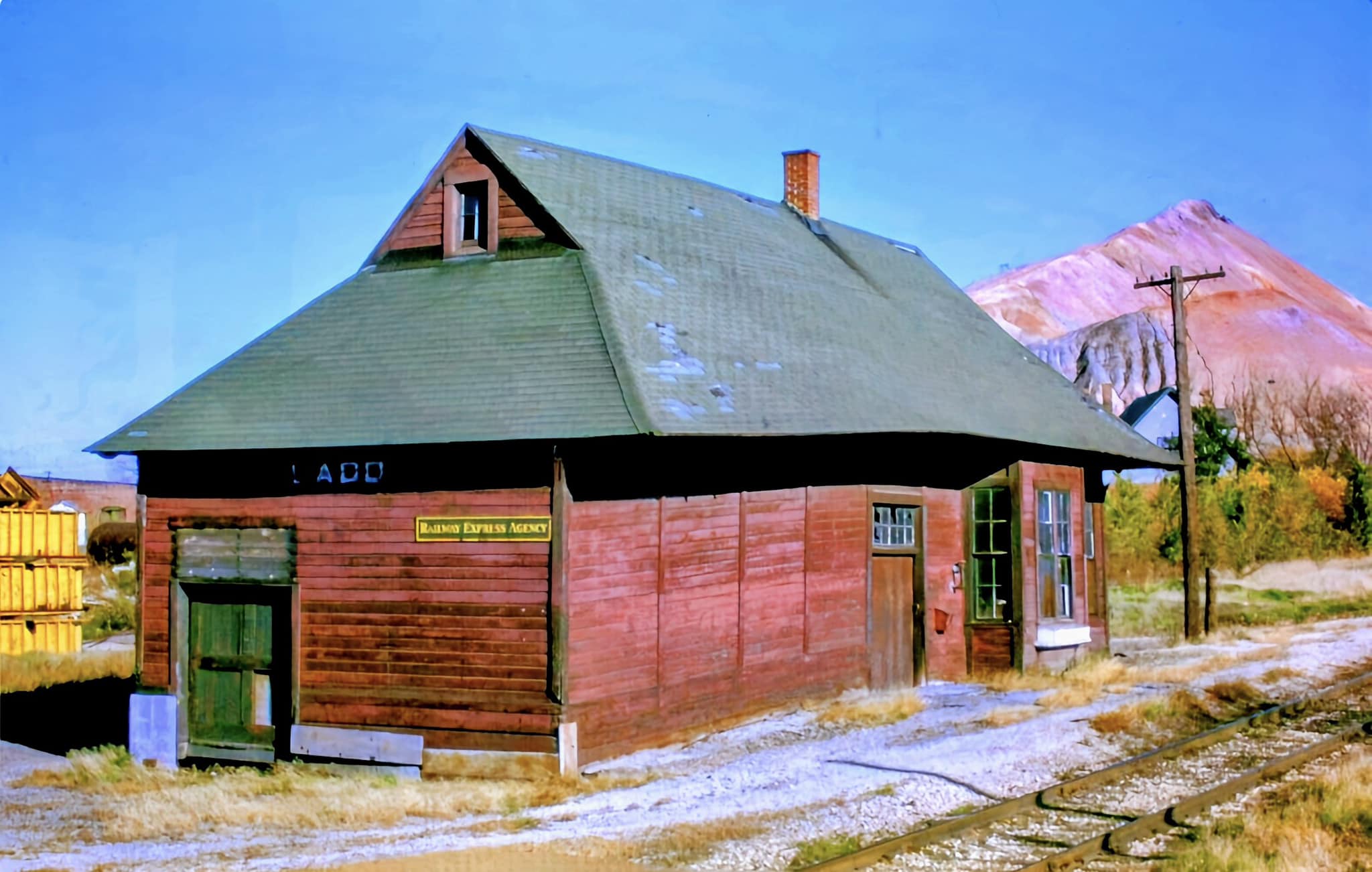
| Andy Zukowski posted Ladd, Illinois was home to the 3rd Vein Coal Company's coal shaft circa 1910. |
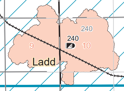
Normally, these Illinois topo maps show the index and mined area of the mine. But this one shows only the tailings pile.
 |
| https://wikiimage.isgs.illinois.edu/ilmines/webfiles/topo-mines/ladd.pdf |
 | |
| Dennis DeBruler commented on Roger's post The Chicago Indiana & Southern became NYC's Kankakee Belt. 1913 La Salle Quadrant @ 1:62,500
|
 |
| Dennis DeBruler commented on Roger's post 1941 Aerial Photo https://clearinghouse.isgs.illinois.edu/webdocs/ilhap/county/data/bureau/flight7/00rr3b007.jpg |
When looking for the satellite location, I noticed that the tailings pile had been terraced but that it is still standing.
 |
| Satellite |
As recently as 2008, there was still a big tailings pile.
 |
| Street View, Oct 2008 |
But they have been removing it.
 |
| Street View, Nov 2022 |
Why did they do all of that work to terrace it if they were going to remove it anyhow?
 |
| Google Earth, Jul 2014 |
At least the tailings pile is no longer pink.
 |
| Andy Zukowski posted via Dennis DeBruler |
No comments:
Post a Comment