 |
| Roger Kujawa posted Freeman Coal Company, Bobby Dick Mine, Williamson County, Illinois, IL, FSA Myron Dudenbostel: Question..... In the heading statement it ends with "FSA", what does that stand for? Thanks in advance....... Pat McCluskey: Myron Dudenbostel farm security administration I believe. Craig Willis: Where was this mine located at in williamson co |
 |
| Directory |
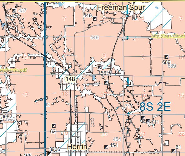 |
| Dennis DeBruler commented on Craig's comment Today's Pond Creek Shooting Range must be using the tipple's land today. The mine ran from 1909-1949 and has the index 449 that is near the top center of this excerpt. The bold number is the tiple, and the grey number marks the polygon showing what was mined. |
 |
| Dennis DeBruler commented on Roger's post |
 |
| Dennis DeBruler commented on Roger's post Neither the 1910 nor the 1936 topo maps show the IC+CB&Q branch that ran along the south side of the mine, but this 1938 aerial does show it. It also confirms that someone dug a new channel for Pond Creek to get rid of some meanders. On today's satellite image we can see a triangle of trees where a wye connected the branch to the CB&Q mainline. The IC tracks on the left side of this aerial excerpt are now also gone but you can see a tree line for the IC+CB&Q branch and the IC mainline on a satellite image. https://clearinghouse.isgs.illinois.edu/webdocs/ilhap/county/data/franklin/flight10/0bgm02055.jpg |

No comments:
Post a Comment