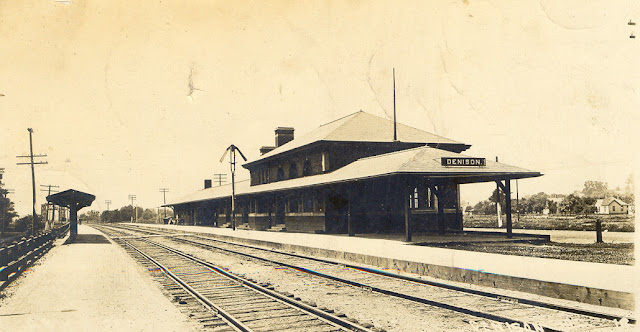
While researching the replacement of the UP/C&NW bridge over the East Boyer River in this town, I came across the following photo. (The bridge is in the left background.)
 |
| photolibrarian Flickr via Bridge Hunter, License: Creative Commons Attribution-NonCommercial-NoDerivs (CC BY-NC-ND) |
 |
| Michael Emerson Avitt posted C&NW depot at Denison, Iowa. |
 |
| Jim Arvites posted Postcard view of the old Chicago & North Western Railway passenger depot at Denison, Iowa circa 1910. The station, built in 1908, unfortunately was torn down in 2021. |
It looks like they removed the two story part and added a bay window to the west side of the building.
 |
| Street View |
It appears they had shortened the building by 1971. That would explain why a depot building is now standing so far away from the town's Main Street. I included the track near the left side of the map excerpt because I was surprised that it was Illinois Central. This must now be CN's mainline to Omaha because a quick look at a satellite map shows that CN, UP and US-30 parallel each other all the way to Woodbine.
 |
| 1971 Denison Quad @ 1:24,000 |
While checking out the CN/IC tracks, I noticed that an ethanol plant takes advantage of the two Class I routes and has rail service from both UP and CN.
 |
| Satellite |
I like it when a railfan picks a grain elevator as a backdrop. It was hard to find good views of the Big Boy #4014 without crowds getting into your view. It looks like Jeff found a view away from the crowds.
 |
| Jeff 515, Aug 2019 |
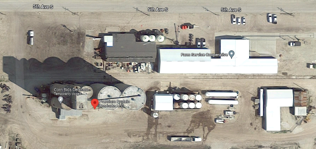
Checking out the grain silos we see in the background of the above Street View, we find a farm service elevator.
 |
| Satellite |
And Galvilon Fiertilizer is a reminder that hauling fertilizer in to a town is as important to farmers as hauling grain out.
 |
| Satellite |
Unlike towns in Illinois and Indiana, meat production is another important rail customer.
 |
| Satellite |

No comments:
Post a Comment