(
Satellite, I could not find the exact location of the tipple)
 |
Roger Kujawa posted
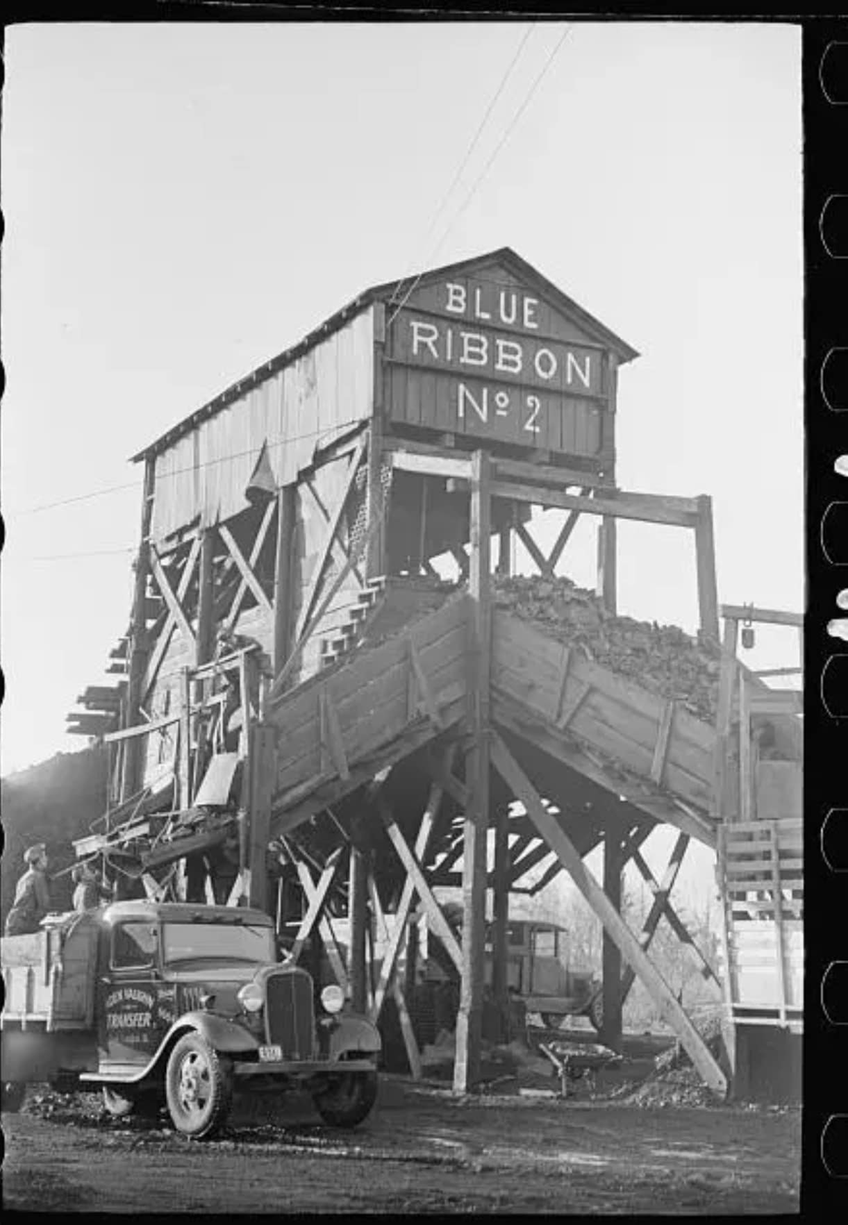
Blue Ribbon No. 2 Mine, Williamson County, Illinois, IL, Arthur Rothstein, FSA, 4
Mark Miller: Roger if I am reading my mine map right that mine is basically across the road from where I live. The mine opened 1936 closed in 1946 and it shows it as a slope mining the Springfield vein. |
Roger Kujawa
posted three photos with the comment: "Blue Ribbon No. 2 Mine, Williamson County, Illinois, IL, Arthur Rothstein, FSA, 6."
 |
| 1 |
 |
| 2 |
 |
| 3 |
 |
Roger Kujawa posted
Williamson County Illinois 1939 Blue Ribbon No 2 Mine Coal Truck Loaders |
 |
| Directory |
I spent too much time on this one because the maps include just the major roads and because the information is not consistent among the sources of information.
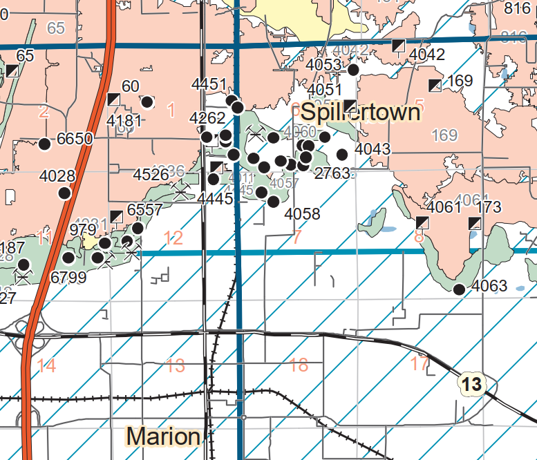
This Springfield seam map has 4049 a little southwest of the "S" in Spillertown.
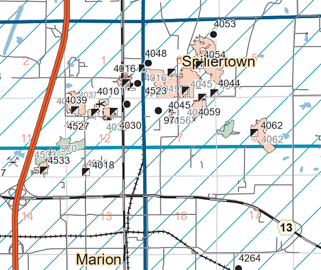 |
| Map-Springfield |
I found the topo map because they have some of the local roads. But it does not have 4049. Then it occurred to me that this might be the Herrin seam instead of the Springfield seam. So...
 |
|
...I got the comparable Herrin seam map. I was surprised that this map and the above map have so few mine indexes in common. In fact, 4451 is the only index I found on both. But this shows the topo map is of the Herrin seam because of the strip mines. I think the blue lines are township lines and they correspond to the red lines on the topo map.
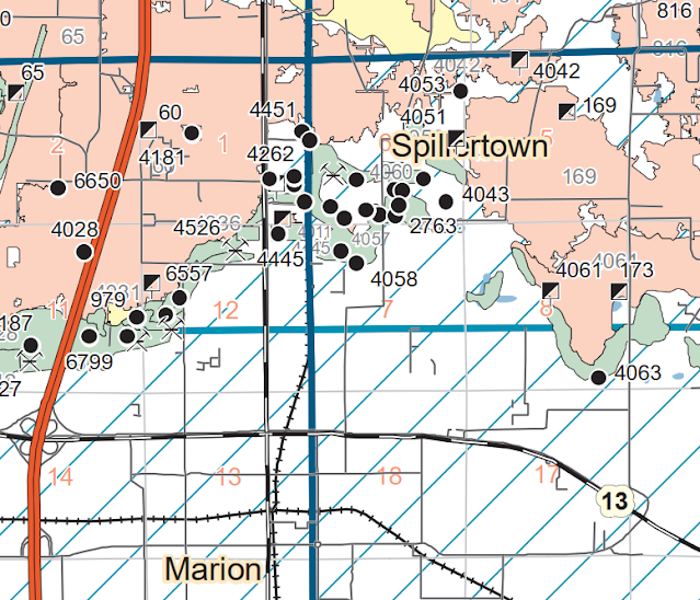 |
| Map-Herrin |
I could not find the tipple on a historical aerial. From the photos, it is obvious that the tipple is not rail served so it would have a small footprint on the aerial. I assume that the C&EI had a coal loading facility that served this and the many other mines in the area.
In fact, some nearby railroads might have provided competitive coal loading facilities.
 |
| 1941 Franklin Quad @ 62,500 |
This was the content of a duplicate post
(
Satellite, this was probably their waste pond.)
 |
Roger Kujawa posted
Loading a truck at Blue Ribbon No. 2 Mine,Williamson County,Illinois,IL,FSA,1
Mark Ballard: North of Marion Mine pond still there Raymond Barr: Located where? |
 |
Directory
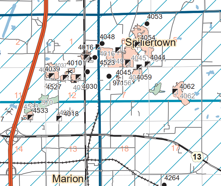
It operated in the Springfield seam. |
 |
| Map |
For a while I was confused because I could not find a rail spur that served the mine. Then I had my "duh" moment: there was no rail service. That is why they are loading trucks. There must have been a coal cleaning and loading facility somewhere next to the C&EI that served the many small mines in this area.







No comments:
Post a Comment