Current: (Satellite)
 |
| LoC via thomas Becher post Cliff Person: Where was it located in town? Rob Pfeiffer: Cliff Person About where Bluff St meets the former C&NW tracks. Still exists but has been moved away from the r-o-w a bit and turned 90 degrees. See Google Maps photo: https://www.google.com/.../data=!3m7!1e1!3m5!1sp9... |
The north/south route was the Milwaukee Road.
 |
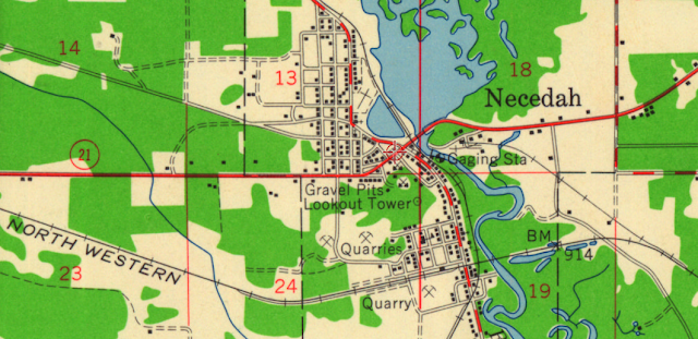
| 1958/60 Necedah Quad @ 48,000 |
The topo map correctly marks the location of the depot. They did move it to the other side of the tracks.
 |
| 1938 Aerial Photo from WIHAP |
No comments:
Post a Comment