.jpg) |
| David Crain posted From the Internet Archive. I wasn't aware of this one. DuQuoin. Charles Bedar: wonder where in duquoin |
 |
| Directory |
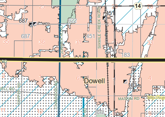
The Elkville quadrangle map does not show this mine. A mistake of that order of magnitute is unusual for those maps. Fortunately, IL-14, US-51 and the CN/IC tracks allows us to identify the location of the 451 tipple and mine.

The mine had been closed eight years earlier than the date of this photo, but the yard tracks are still visible. In fact, judging from the shadow, the tipple is still standing a little south of the lake.
 |
| 1938 Aerial Photo from ILHAP Dennis DeBruler answered Charles' question This mine is about halfway between downtown DuQuoin and Dowell. It occupied the cluster of trees that we now see south of IL-14 and west of the CN/IC tracks. Some details are here: https://clearinghouse.isgs.illinois.edu/webdocs/ilhap/county/data/perry/flight9/0bgy3004.jpg |
No comments:
Post a Comment