Depot: (Satellite, northwest quadrant of the crossing)
Tower: (Satellite, northeast quadrant of the crossing))
Water Tower: (Satellite)
Original Grain Elevator: (Satellite)
Wood Grain Elevator: (Satellite)
Bioenergy Plant: (Satellite, the loop tracks for handling unit trains caught my eye.)
M&SL = Minneapolis & St. Louis. It was bought by C&NW in 1960.
M&SL is the north/south route through town. According to the 2004 SPV Map, C&NW abandoned the "spoke" to the south. The other three spokes are now owned by UP.
We are looking east along the C&NW.
 |
| Raymond Storey posted |
I was able to determine the locations of the features in the photo from this aerial. The long shadows made it easy to identify the features.
 |
| Jul 10, 1953 @ 23,600; AR1WY0000020016 |
As usual, I started my research with the oldest high-resolution aerial that I could find. But the dark exposure made it hard to find the buildings. That is why I got the above aerial.
 |
| May 25, 1947 @ 27,200; AR1DY0000060177 |
The grain elevator has grown a little bit.
 |
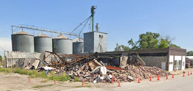
| Street View, Aug 2021 |
I wonder about the purpose of the wood structure that was built on top of the one-story building.
 |
| Street View, Aug 2021 |
Most of the grain from the local farmers would be delivered here.
 |
| Satellite |
Since the plant handles both hoppers and tankers, it probably produces ethanol or biodiesel or both. [ldc] I noticed two blue locomotives, so LDC evidently has their own locomotives for loading the trains.
 |
| Satellite |
I thought just four silos was a rather low number until I saw that the jump-form silos are big.
 |
| Street View, Aug 2021 |
No comments:
Post a Comment