 |
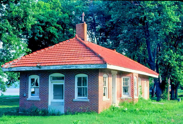
| Andy Zukowski posted Chicago & Eastern Illinois Railroad Station in Thebes, Illinois. |
 |
| Andy Zukowski posted Chicago and Eastern Illinois Railroad Depot in Thebes, Illinois (c. 1910) Richard Fiedler shared |
 |
| Andy Zukowski posted Chicago & Eastern Depot in Thebes, Illinois. 1982 Dave Wallace: Nice brick! .. is this original location Dennis DeBruler: Dave Wallace I don't think you could see the river that is in the background from the original location. Andy Zukowski posted with a similar comment Jim Kelling shared |
.png) |
| Dennis DeBruler commented on Andy's post 6th Street goes down near the tracks because that was the location of the depot, https://www.google.com/maps/@37.216584,-89.4596553,243m/data=!3m1!1e3?entry=ttu https://clearinghouse.isgs.illinois.edu/webdocs/ilhap/county/data/alexander/flight3/0bfz1040.jpg |
 |
| Dennis DeBruler commented on Andy's post The C&EI met the St. Louis Sothwestern Railway (Cotton Belt, SSW) and Missouri Pacific Railroads here. So did the IC because the C&EI shared the riverfront tracks to the south of Thebes. So all four of these railroads had trains that rolled past this depot. (Topo maps do not label shared railroad routes. I used another map to confirm that the track under the Thebes Bridge that goes North to meet the SSW+MP was shared by IC and C&EI.) 1966 Thebes Quad @ 24,000 |
I'm learning that aerial photos vary a lot even though I think they are taken just a few seconds apart. Note how different the shadow for the approach of the bridge is in this photo.
.png) |
| 1938 Aerial Photo from ILHAP |
I got curious as to where C&EI and IC quite sharing the route south of Thebes. The answer is Olive Branch, IL. I had to go back to older topo maps because IC rather quickly abandoned this route. Also note that this map does label the route west of Olive Branch as shared between IC and C&EI.
 |
| 1934 Thebes Quad @ 62,500 |
No comments:
Post a Comment